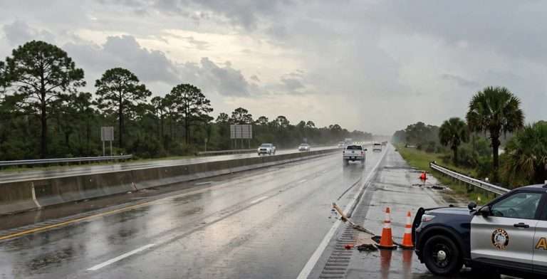
Heavy Rain Weekend Brings Flash Flood Risk, Rip Currents and Drought Relief to South Alabama
Heavy rain is expected across South Alabama this weekend, with up to 8 inches possible near the coast, a rising flash flood risk, very dangerous rip currents and welcome relief for drought-stricken areas.
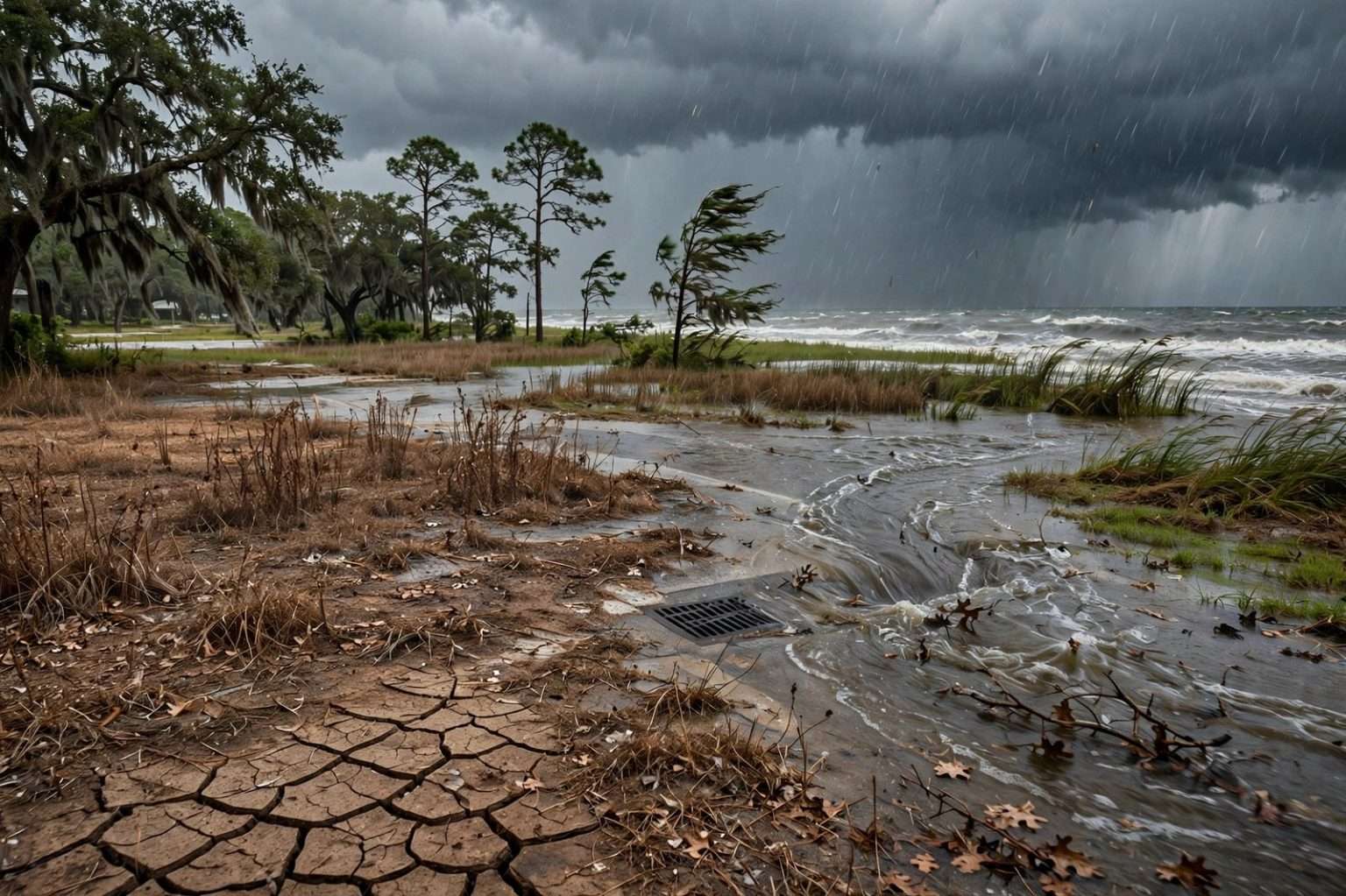
MOBILE, Ala. — A heavy rain weekend is underway across South Alabama and the rest of the central Gulf Coast, where forecasters expect downpours to soak the region Saturday and Sunday, raising the risk of flash flooding, street flooding and dangerous rip currents while delivering long-awaited relief to a landscape gripped by drought.
The National Weather Service said rain chances would build across Alabama from Friday through Sunday, with the southwest corner of the state, including Mobile and Baldwin counties, in line for the largest totals. Forecasters stressed that no severe weather is expected statewide, but they warned that bands of heavy downpours could overwhelm drainage systems in spots, particularly near the coast.
The setup is a familiar one for early fall on the Gulf Coast. Forecasters said very moist air streaming north from the Gulf, an approaching cold front and a possible area of low pressure developing over the Gulf are expected to combine to produce repeated rounds of rain through the weekend. Sunday is expected to bring the highest rain chances statewide.
How the Weekend Is Expected to Unfold
The wet pattern began to take hold Friday night, when rain chances climbed to around 60% under muggy skies. Overnight temperatures were forecast to stay in the lower to middle 70s. Friday night’s showers were expected to be scattered rather than widespread, a preview of what is to come.
Saturday is when the rain is expected to ramp up in earnest. Forecasters said showers are likely to develop first near the coast during the morning, then push inland by around lunchtime and continue through the afternoon and evening. Humid conditions are expected throughout the day, and rain chances stay elevated Saturday night.
Sunday is expected to be the wettest day of the stretch. Rain is likely through much of the day, and that is when the heaviest totals are forecast to fall. The National Weather Service office in Mobile said numerous showers and storms are expected across southwest Alabama through the weekend, and that some of those storms could produce heavy rainfall capable of causing localized flash flooding.
Thunderstorms are also likely over the Gulf waters, where they could kick up gusty winds and drop additional heavy downpours along the beaches.
How Much Rain Could Fall
Rainfall forecasts vary by location, and the heaviest amounts are expected closest to the coast. Here is a look at the ranges forecasters have outlined:
- Most of the local forecast area: 2 to 4 inches over the weekend.
- Coastal sections: More than 5 inches possible, with long-range models suggesting some coastal communities could see 5 to 7 inches through early next week.
- Southwest Alabama near the coast: The National Weather Service said a sizable area could receive 4 to as much as 8 inches of rain through Sunday night.
- The rest of south Alabama: Generally 1 to 2 inches.
- North Alabama: Roughly a half-inch to 1.5 inches.
The weather service cautioned that the outlook for northern Alabama could be revised downward depending on the cold front, including how fast it moves and where it eventually stalls over the state. Totals in South Alabama, meanwhile, will depend heavily on where the heaviest bands of rain set up, meaning neighborhoods only a few miles apart could see very different amounts.
Flash Flood Risk Levels Climb Through Sunday
Forecasters use a four-level scale to describe the risk that rainfall will be heavy enough to cause flash flooding. Level 1 is a marginal risk, Level 2 is a slight risk, Level 3 is a moderate risk and Level 4 is a high risk. The categories describe the chance that rainfall will exceed what the ground and drainage systems can handle near any given point.
For this event, the weather service outlined a steady increase in risk:
- Friday: A Level 1 of 4 (marginal) risk of excessive rainfall for south Alabama.
- Saturday: The risk rises to Level 2 of 4 for southwest Alabama, with a Level 1 risk across the rest of the state.
- Sunday: The entire state is under a Level 2 of 4 risk of excessive rainfall.
A Level 2 risk does not mean widespread flooding is expected. It does mean that isolated flash flooding is possible, and in urban areas such as Mobile, where pavement and older drainage systems can be quickly overwhelmed, even a short burst of intense rain can send water into streets and low-lying intersections.
Forecasters said that as the ground becomes saturated over the course of the weekend, residents should be prepared for localized street flooding and drainage problems. Rain that soaks in easily on Saturday may run off much more quickly by Sunday, when the heaviest rain is expected.
Coastal Flooding and Dangerous Rip Currents
The weekend will be a poor one for a trip to the beach. Forecasters described the rip current risk along the coast as high to very high, and swimming is not advised. Dangerous surf conditions are expected to continue through Saturday and Sunday.
Minor coastal flooding is also possible, with forecasters noting the potential through at least Saturday morning. Minor coastal flooding typically means water covering low-lying roads, parking lots and yards near the shoreline and along bays and bayous, especially around high tide.
Rip currents are powerful, narrow channels of water flowing away from the shore, and they can pull even strong swimmers out into deeper water. Beaches along the Alabama coast, including Gulf Shores and Orange Beach, use a colored flag system to communicate surf conditions. Red flags signal a high hazard, and double red flags mean the water is closed to the public. Beachgoers should check posted flags and follow the instructions of lifeguards and local officials.
Rain Arrives Amid Worsening Drought
For all the concerns about flooding, the rain is also welcome news. A long dry stretch has left Alabama increasingly parched, and any rain will help after a dry week.
The latest U.S. Drought Monitor, released Thursday, showed nearly all of Alabama either in drought or on the verge of drought. The driest areas are in southwest Alabama, where conditions have reached extreme drought, Level 3 of 4 on the monitor’s drought scale.
The U.S. Drought Monitor is a weekly map produced jointly by the National Drought Mitigation Center at the University of Nebraska-Lincoln, the U.S. Department of Agriculture and the National Oceanic and Atmospheric Administration. It ranks conditions from “abnormally dry” through moderate, severe, extreme and exceptional drought.
One weekend of heavy rain may not erase months of dryness, but a soaking of several inches can help recharge soil moisture, ease stress on lawns, gardens and crops, and lower the risk of wildfires that tends to rise when vegetation dries out. Rain falling on hard, dry ground can also run off quickly at first, which is one reason forecasters are keeping a close eye on flash flooding even in a drought.
Flood Safety: Turn Around, Don’t Drown
The National Weather Service’s longstanding message for flooded roads is simple: Turn Around, Don’t Drown. Forecasters said motorists should avoid flooded roadways and use caution during the heaviest periods of rain. Standard weather service flood safety guidance includes the following:
- Never drive through flooded roads. The weather service notes that just 6 inches of fast-moving water can knock an adult off their feet, 12 inches of moving water can carry away most cars, and 2 feet of rushing water can sweep away SUVs and trucks.
- Don’t trust the depth. Floodwater is often deeper than it looks, and the road underneath may be damaged or washed out.
- Be extra careful at night. Flooded roads are much harder to see in the dark.
- Stay out of floodwater on foot. Moving water can be powerful, and floodwater can hide debris, open storm drains and downed power lines.
- Keep children away from ditches, drains and creeks. These areas can fill and flow rapidly during heavy rain.
- Have a way to get alerts. Keep a phone charged and make sure Wireless Emergency Alerts are turned on, or use a NOAA Weather Radio, so you receive any flash flood warnings issued for your area.
- Know the difference between a watch and a warning. A flash flood watch means conditions are favorable for flash flooding. A flash flood warning means flash flooding is happening or about to happen, and you should move to higher ground immediately if you are in a flood-prone area.
Beach and Rip Current Safety
With a high to very high rip current risk in place, the safest choice is to stay out of the Gulf this weekend. For anyone near the water, weather service guidance on rip currents includes these steps:
- If you are caught in a rip current, don’t fight it. Stay calm and float to conserve energy.
- Swim parallel to the shore to escape the current, then swim at an angle back toward land.
- If you can’t escape, face the shore and wave and yell for help.
- If you see someone in trouble, get help from a lifeguard or call 911. Throw the person something that floats, and do not go in after them unless you are trained to do so.
- Heed the flags. Never enter the water when double red flags are flying.
Practical Steps for Residents This Weekend
With rain expected to fall heavily at times, residents can take a few simple steps to reduce problems at home and on the road:
- Clear leaves and debris from gutters, downspouts and any storm drains near your home so water can flow freely.
- Move vehicles out of low spots that tend to flood, especially near the coast where minor coastal flooding is possible.
- Allow extra travel time, slow down and turn on headlights in heavy rain. Wet roads after a long dry spell can be especially slick.
- Check the forecast before heading to outdoor events and have a backup plan.
- Report flooded roads to local authorities and call 911 in an emergency.
Looking Ahead to Next Week
Relief from the wet pattern is in sight. Drier air is expected to move into the region next week, with rain chances tapering off Monday and Tuesday as conditions improve. Overnight lows are forecast to dip into the 60s, and daytime highs are expected to settle around 80 degrees by the middle of the week, a pleasant change after a humid, waterlogged weekend.
Rain chances may not disappear entirely, however. The weather service said they will linger into next week, especially in south Alabama, although they are not expected to be particularly high for most of the state. South Alabama remains the exception, with at least some chance of rain in the forecast each day through at least Thursday.
Residents should continue to monitor forecasts from the National Weather Service office in Mobile through the weekend, as rainfall totals and flood risk levels may be adjusted as the cold front and any Gulf low pressure system take shape.
Update (Sunday, Oct. 4): Flooding Threat Continues Through Monday Morning
Forecasters say the wet, unsettled pattern will continue across the Gulf Coast into early next week as deep tropical moisture fuels multiple rounds of heavy rain. A Flood Watch remains in effect for coastal portions of southwest Alabama and northwest Florida, where rainfall rates could reach 2 to 3 inches per hour at times.
Rainfall totals: Totals of 4 to 6 inches are forecast across much of the area through Monday, with 2 to 3 inches possible in far northern southwest Alabama. Localized amounts of 10 to 15 inches are possible, particularly along and south of Interstate 10, where storms may repeatedly move over the same locations. The heaviest rain is expected Saturday evening and again Sunday morning through the afternoon, and some rivers are forecast to reach flood stage in the coming days.
Severe weather: Widespread severe weather is not expected, but a weak area of low pressure could develop near the coast Sunday, bringing a low-end risk of isolated tornadoes or waterspouts. Highs will stay mainly in the lower 80s.
Coastal flooding: A Coastal Flood Advisory is in effect from midnight through 8 a.m. Sunday. Water levels could reach up to 2 feet above normally dry ground in vulnerable spots, including Dauphin Island and Fort Pickens, and splashover is possible along the Causeway.
Rip currents: A high risk of life-threatening rip currents will continue through at least Monday, with red flags flying on area beaches and surf of 3 to 4 feet. The risk is expected to drop to moderate Monday night into Tuesday before possibly returning to high by Wednesday, when surf could approach High Surf Advisory criteria.
Cooler air ahead: A cold front is expected around Tuesday, bringing drier, cooler fall air, though stronger winds behind the front could push marine conditions toward advisory levels by midweek.
Tropics: The National Hurricane Center is monitoring the southwestern Gulf, where a broad area of low pressure could form. Development chances are near 0% over the next 48 hours and 20% over the next seven days.
Never drive through flooded roadways, and continue to monitor the latest forecasts and alerts.