

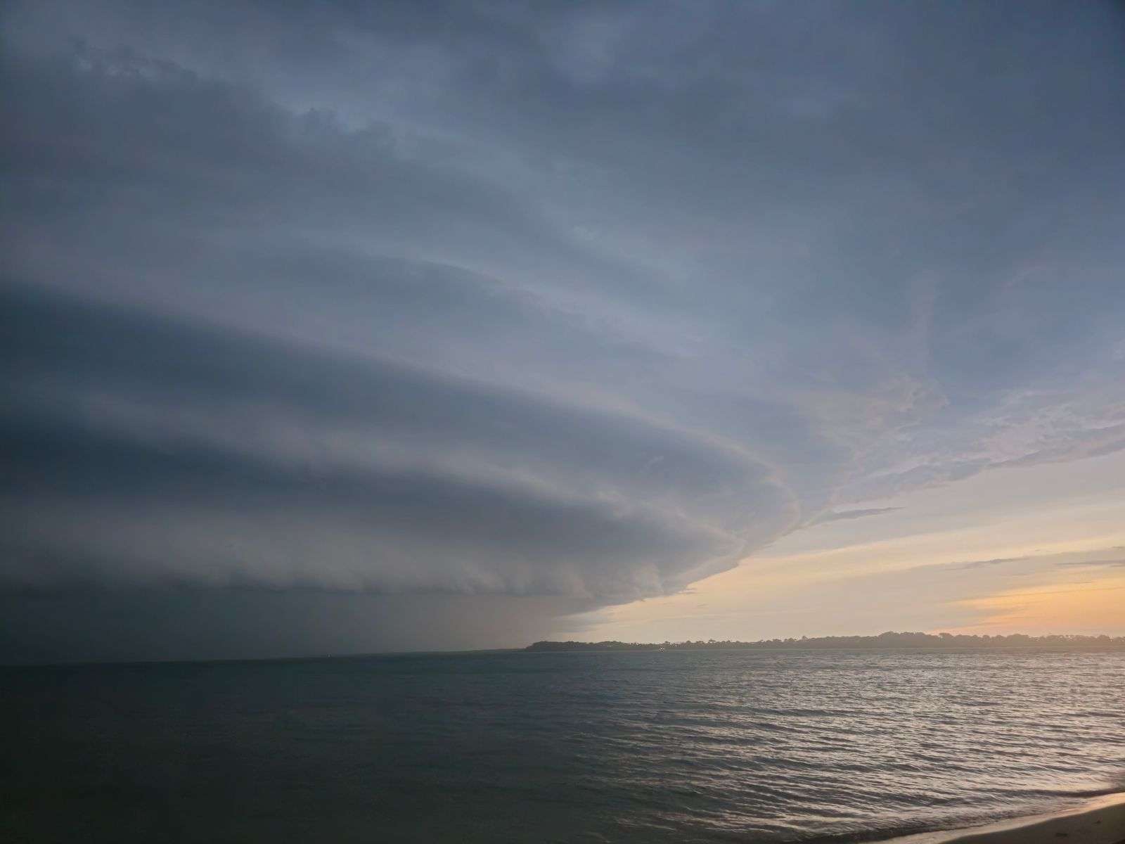
A slow-moving cold front pushing toward the Gulf Coast is expected to bring rounds of showers and thunderstorms overnight into Sunday morning, while dangerous rip currents and rough surf continue to threaten swimmers at area beaches. The two hazards move on different clocks — storms overnight, surf dangers all weekend — and together they make Saturday night into Monday a period when residents and visitors need to track the sky as closely as the tide charts.
Storm Timing Overnight
Forecasters said storm activity was expected to pick up significantly Saturday evening after a relatively quiet afternoon. Showers and thunderstorms building over central Mississippi were forecast to track southeast into southwest Alabama and southeast Mississippi around midnight before spreading across the rest of the Gulf Coast overnight, with storms reaching coastal communities after roughly 4 a.m.
The timing puts the most active weather over the region while most people are asleep — a classic setup for a quiet warning period, since storms that arrive at 4 a.m. are frequently the ones residents sleep through. Anyone in a flood-prone home, in a low-lying neighborhood, or camping near the coast had reason to make sure alerts could reach them overnight, with the storms crossing the state line well after dark.
While the strongest atmospheric energy is expected to stay north of the area, forecasters said enough instability will remain in place for a few stronger storm cells. Those storms could produce wind gusts up to 45 mph, heavy rainfall, frequent cloud-to-ground lightning and brief drops in visibility.
Gusts of that speed are enough to down branches and scatter unsecured lawn furniture, boats and trash cans, and they are a genuine hazard for anyone on the water. The lightning forecast matters as much as the wind: a front crossing the coast in the overnight hours puts cells over Mobile Bay, the Intracoastal Waterway and the beach towns in sequence, and the storm’s leading edge can arrive with little visual warning for boaters already in open water.
Slow-Moving Front Raises Flooding Concerns Sunday
The front is expected to keep drifting toward the coast through Sunday morning before stalling near or just offshore. An additional disturbance moving through around sunrise is forecast to help storms redevelop along the boundary. Because the front will be moving slowly, forecasters warned storms could repeatedly track over the same areas, raising the risk of heavy rainfall totals.
Current forecast models suggest the heaviest rain, with localized totals of 4 to 6 inches, will likely stay just offshore. However, forecasters cautioned that if the front stalls farther south than expected, parts of the Alabama and northwest Florida coast could see those higher totals as well, raising the potential for flash flooding in low-lying and poorly drained areas.
The difference between four inches offshore and four inches over Mobile or Pensacola is the difference between a routine rainy Sunday and a morning of flooded streets. Coastal Alabama’s drainage infrastructure is built for the region’s usual summer downpours, but slow frontal rain that trains over the same basins for hours can overwhelm even well-maintained systems, and the usual suspects — underpasses, low spots near the bay, poorly drained subdivisions — fill first.
Forecasters said pinpointing exactly where the front settles remains one of the bigger challenges heading into Sunday. A shift of thirty or forty miles in the front’s stall point decides whose Sunday stays dry and whose streets flood, and that kind of small-scale detail is rarely locked in until the boundary itself is nearly in place.
Highs Sunday afternoon are expected to reach the upper 80s to near 90 degrees, though clouds and rain could keep some areas cooler.
Drier, More Comfortable Air Expected Behind the Front
The front is forecast to weaken and wash out Sunday night into Monday as the upper-level trough responsible for the unsettled weather moves east of the region. Behind it, a noticeably drier air mass is expected to move in, with dew points falling into the 60s across much of the area. Forecasters said that should make mornings and evenings feel considerably more comfortable after weeks of oppressive humidity.
The change will be as noticeable as the storms themselves. Gulf Coast summers in which dew points hold in the mid-70s make every outdoor task feel heavier, and the drop into the 60s — modest by the standards of anywhere else — reads as genuine relief here. The first dry morning after a stretch like that is when lawns get mowed, roofs get patched and anglers who spent a week watching the sky finally launch.
Rain chances are expected to drop off significantly during the first half of next week, with any showers or storms largely limited to afternoon sea breeze activity near and east of Interstate 65. Afternoon highs will stay in the lower to middle 90s, but lower humidity should keep heat index values below Heat Advisory criteria for much of the week.
The pattern that follows a washed-out front like this one is familiar to anyone who has spent a summer on the Gulf Coast: hot sunshine, a building sea breeze each afternoon, and the brief pop-up storms the breeze triggers inland before the day’s heat ebbs. With dew points down, even those afternoon storms should feel less suffocating than the ones that preceded the front.
Beaches Remain Dangerous Through the Weekend
A High Risk of rip currents remains in effect through Sunday night for all Alabama and northwest Florida Gulf beaches. Persistent onshore winds ahead of the front continue to generate rough surf and powerful rip currents capable of pulling swimmers away from shore, forecasters said. That risk is expected to ease to a Moderate Risk on Monday and drop further to a Low Risk by Tuesday as winds and surf gradually calm down.
Rip currents are the leading weather-related killer at Gulf beaches, and a High Risk designation is the level at which officials urge even strong swimmers to stay out of the surf. The currents form in channels where water piled up by onshore winds returns seaward, and they do not pull swimmers under — they pull them out, into water over their heads, where exhaustion and panic do the rest. The escape is sideways: swim parallel to shore until free of the current, then angle back in.
Scattered thunderstorms are also possible near the beaches overnight into Sunday, bringing additional lightning and gusty wind danger. A beach that is closed to swimmers because of surf is doubly dangerous when lightning is in the area, and the storms arriving after roughly 4 a.m. will reach the shoreline communities before lifeguards and flags can do much to warn anyone.
Hazardous Conditions Also Expected on the Water
Boaters should also brace for hazardous conditions through Sunday. Moderate to occasionally strong winds, combined with storms capable of producing higher gusts and reduced visibility, are expected to create difficult conditions on coastal waters. Forecasters urged anyone planning to be on the water to monitor the latest forecasts closely and be ready to seek safe harbor if storms move in.
Mobile Bay and the nearshore Gulf turn rough quickly when sustained winds build against an outgoing tide, and the overnight storm timing puts fishing boats, sailboats and weekend pleasure craft at their most exposed. The safest plan for the weekend is the simplest one: keep the boat at the dock until the front passes and the risk designations along the beach step down — which, by the forecast, should arrive with Tuesday’s calmer winds and drier air.
Reading the Rip Current Flags
For visitors, the risk designations that appear in forecasts translate directly to the flags flying at guarded beaches along the coast. Green means calm conditions, yellow means caution, red means dangerous water, and double red means the water is closed. A High Risk designation in the forecast generally corresponds to red flags — and on high-risk days, the rescues happen fast and in clusters, because beachgoers who swam without trouble the previous afternoon find the water transformed overnight.
The transformation comes from wind direction as much as strength. Persistent onshore flow, like the pattern running ahead of this front, pushes surface water against the coast until it has to find its way back out, and it exits through concentrated channels that run faster than most people can swim. The channels shift from day to day with the sandbars, which is why even frequent visitors cannot judge them by memory.
The progression from High to Moderate to Low Risk over Monday and Tuesday tracks the same wind that caused it. Once the front passes and the flow turns offshore or slackens, the surf energy that builds the currents subsides, and the beaches return to their normal late-summer state within a couple of tide cycles.
What Sunday’s Uncertainty Means for Residents
The weekend’s forecast is, at bottom, a story about a front whose exact behavior no one can yet pin down. If it moves fast and stays south, coastal Alabama gets an overnight storm, a damp Sunday, and a beautiful workweek. If it stalls over the coast, Sunday becomes a day of training storms and localized flooding totals, and the cleanup runs into the workweek the drier air was supposed to open.
The practical guidance is the same either way. Secure the yard Saturday evening before the first cells arrive around midnight. Set alerts to wake you if warnings are issued for your county overnight. Move flood-prone vehicles to higher ground. Keep Saturday’s beach plans short and Sunday’s off the water entirely, and let the Moderate and Low Risk days that follow provide the swimming and boating the weekend could not.
The relief behind the front is real and worth waiting for — dew points in the 60s, heat indices below advisory levels, rain limited to the afternoon sea breeze east of Interstate 65. Getting there just requires getting through one slow front, one high-risk stretch of surf, and one overnight of storms that will cross the coast while most of the Gulf Coast is asleep.