
Hurricane Sally Weakens to Category 1 but Slow Crawl Toward Mobile Bay Keeps Flood Threat High
Hurricane Sally weakened to a Category 1 storm Tuesday but its slow crawl toward Mobile Bay kept flooding and storm surge threats high, prompting officials to urge evacuations ahead of a Wednesday morning landfall.
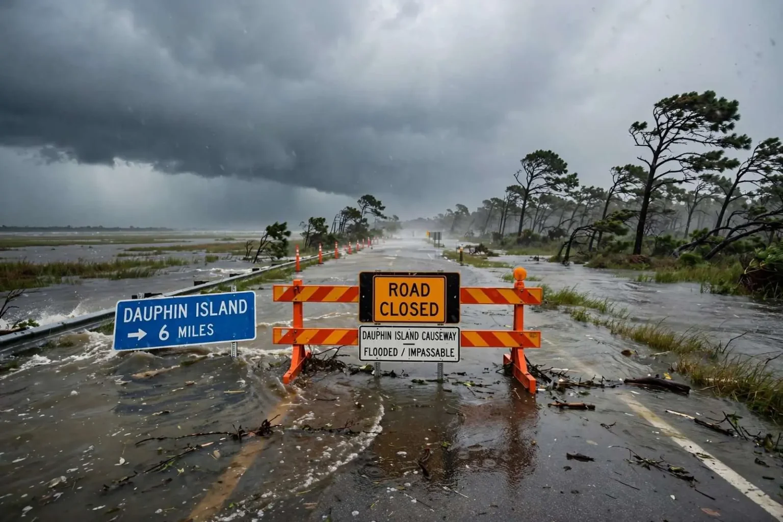
Hurricane Sally weakened to a Category 1 storm Tuesday but continued its unusually slow approach toward Mobile Bay, prompting local and state officials to urge residents in low-lying areas and mobile homes to evacuate before the worst conditions arrive. The storm was expected to make landfall along the Alabama coast Wednesday morning, a day later than earlier forecasts had suggested. The delay, far from being good news, extended the most dangerous feature of the storm: the hours of relentless onshore wind and water that a slow-moving hurricane piles onto a coastline.
Sally had spent days organizing in the Gulf of Mexico, and its crawl — a forward speed measured in single-digit miles per hour — meant that communities along the Alabama and Mississippi coasts would endure tropical conditions far longer than a typical landfalling hurricane delivers. Rainfall totals climb with duration, surge sits against the shore instead of passing, and the wind, even at Category 1 strength, has hours longer to strip trees, down lines and drive debris.
At a Tuesday morning press conference alongside Gov. Kay Ivey, John De Block of the National Weather Service said Sally’s forward track had shifted slightly east since Monday’s briefing, but that rain, wind and storm surge remained serious concerns even with the storm’s weakened wind speeds.
“As of 10 o’clock, Sally was about 110 miles south of Mobile drifting to the north at the speed of a child in a candy shop — about two to three miles per hour,” De Block said. “We’re looking at it making landfall tomorrow morning now, a little later than we had been talking about earlier. We’re expecting winds about 70 knots or 80 miles per hour when Sally makes landfall tomorrow, and right now the projected path is right up Mobile Bay. If this forecast continues to shift to the east — as it very well may — that will decrease the amount of storm surge that is encountered in Mobile Bay, which will be good news.”
The geography of that projected path explains the concern. Mobile Bay opens to the south, and a storm tracking straight up the bay pushes surge into its narrowing upper reaches — past the causeway communities, into the Mobile-Tensaw delta and against the downtown waterfront. An eastward shift, by contrast, moves the worst surge toward the Baldwin County shore, sparing the upper bay. Small changes in track mean large changes in who floods, which is why forecasters repeat the same warning at every briefing: do not plan around the skinny line on the map.
‘You have an extra 24 hours to get out’
Mobile County Sheriff Sam Cochran urged residents who did not feel safe to leave rather than wait out the storm, noting that evacuating ahead of time also protects law enforcement and first responders who would otherwise have to conduct rescues once conditions worsen.
“We’re urging you to evacuate, especially those in south Mobile County, or those close to a river, stream or creek,” Cochran said. “We don’t want to put people at risk. You have an extra 24 hours to get out.”
The sheriff’s arithmetic was simple: every rescue mission launched at the height of the storm puts deputies, EMS crews and the people being rescued in danger, and every resident who leaves early removes one from that equation. South Mobile County — Bayou La Batre, Coden, Grand Bay, the communities along the bay’s western shore and the delta’s flood-prone creeks — is the part of the county where water arrives first and leaves last.
Conditions were already deteriorating in southern Mobile County by Tuesday morning, as rising surge pushed water and debris across roadways. Mayor’s officials announced on Facebook that the causeway leading to Dauphin Island had been closed after flooding made the route impassable, cutting off the barrier island’s main land link even before Sally’s core arrived. The closure was the storm’s first hard boundary: once the causeway went under, anyone remaining on the island was committed to riding out the hurricane with the Gulf on one side and the bay on the other.
‘It seems to be changing by the hour’
Mobile County Emergency Management Deputy Director Mike Evans echoed warnings he issued Monday about the uncertainty still surrounding Sally’s track and intensity, saying that unpredictability itself poses a danger for residents trying to plan ahead.
“Is there uncertainty? Absolutely,” Evans said. “Is the storm changing? It seems to be changing by the hour. Each change could mean harsher conditions for us, or they could go the other way, but we’re not going to talk about that right now.”
The candor was deliberate. Emergency managers spend landfall season translating probabilistic forecasts into concrete instructions — evacuate here, shelter there — and the honest answer to “where exactly will it hit?” changes with each model run. Evans’s message to residents was to plan for the range of possibilities rather than the center of the cone: a storm that has already wobbled overnight can wobble again, and the difference between a Category 1 and the stronger system it had briefly threatened to become is measured in the decisions people make while the models still disagree.
Both Mobile and Baldwin counties remained under a hurricane warning, a storm surge warning and a flash flood watch as of Tuesday. The combination covered every mechanism by which Sally could hurt the coast: sustained destructive winds, water pushed ashore by the storm itself, and the inland flooding that hours of torrential rain would produce on saturated ground. Evans said forecasters do not expect conditions to improve before the storm’s core arrives.
“Our colleagues at the National Weather Service believe severe weather is on the cusp of getting here,” he said.
Shelters, with a pandemic twist
Mobile County’s two public shelters remained open Tuesday. The general shelter is located at Theodore High School, while a special needs shelter is operating at Burns Middle School. The two-shelter arrangement separates the general evacuee population from those whose medical conditions require electricity, monitoring or nursing support, concentrating scarce medical resources in one facility.
Because of COVID-19 protocols, the Theodore High School shelter is limited to a capacity of about 250 people, Evans said. The shelter was not close to that limit as of Tuesday, but the county has an additional shelter on standby if space runs short.
The pandemic had transformed hurricane sheltering across the Gulf Coast in 2020. The old model — gymnasiums packed shoulder to shoulder on folding cots — was incompatible with social distancing, so counties slashed shelter capacities, spaced cots, screened arrivals and prepared standby sites to absorb overflow. The result was a landfall season in which the usual advice — “go to a shelter” — carried its own calculus, and many residents were urged instead to stay with family or friends inland. For the evacuees who did come, the capped capacity made early arrival more important than ever, because the alternative if the shelter filled was a standby site opening at the worst possible hour.
If you stay, prepare for 72 hours
For residents planning to ride out the storm rather than evacuate, Evans recommended stocking enough food, water and battery-powered electronics to last up to 72 hours without power. He also cautioned residents to follow safety guidelines when running generators, including keeping them outdoors and away from windows to avoid carbon monoxide buildup.
The 72-hour standard reflects the reality of post-storm recovery: with a slow-moving system, crews cannot begin assessing damage until winds drop, flooded roads must drain before line trucks can roll, and utility repairs in a wide disaster area take days. A household that can feed itself, hydrate and keep phones charged for three days is not dependent on the first chaotic hours of the response. The generator warning, likewise, addresses a danger that reliably outlasts the storm itself — carbon monoxide from generators run in garages, on porches or too near windows, which kills more people after some hurricanes than the wind does during them.
“There’s time to get ready, and there’s no time like right now,” Evans said. “If you feel unsafe, get to somewhere safe.”
Officials said they would continue to monitor Sally’s track through the day Tuesday and provide updates as the storm nears the coast. The county’s briefings would continue on the same rhythm as the storm itself — slow, steady and, for everyone in its path, impossible to ignore.
The slow-motion approach also tested the region’s patience in a way fast hurricanes do not. A storm that crosses the coast in an afternoon produces a familiar rhythm — warning, impact, damage assessment. Sally instead stretched the anticipation across days: the shift east, the delay in landfall, the water already creeping across the causeway roads while the center remained well offshore. Emergency officials spent Tuesday managing not just the storm but the waiting, using every briefing to counter the tendency of residents to stand down when the worst hour keeps moving back.
For coastal Alabama, the sequence was a familiar one updated for a pandemic year: the same geography of vulnerability — the barrier islands, the bayside communities, the delta creeks — now overlaid with shelter capacity limits and distancing rules that changed the arithmetic of evacuation. The county’s answer was the one Evans summarized: leave if you feel unsafe, prepare for three days if you stay, and use the extra 24 hours the storm’s slowness had given you. The water on the Dauphin Island causeway was the reminder that the extra time was already running out.