Mobile Braces for Scorching Heat Before Dramatic Cooldown
South Alabama swung from a heat index above 105 degrees to lows near 66 within days as a rare late-summer cold front moved through the Gulf Coast.
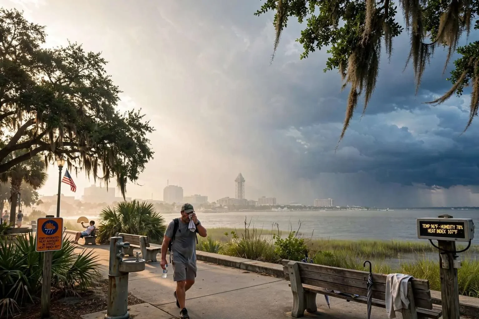
Gulf Coast residents were in for a wild temperature swing this week, with South Alabama forecast to go from stifling late-summer heat to unusually cool nights within a matter of days. The whiplash — triple-digit heat indices giving way to lows in the mid-60s — offered an early taste of autumn in a region where summer usually refuses to yield without a fight.
Forecasters said Sunday’s heat index was expected to climb above 105 degrees across the Mobile area, with actual temperatures reaching into the upper 90s. The heat index, which combines temperature with humidity to measure how hot it feels to the human body, is the number that matters most along the Gulf Coast, where moisture-laden air off the Gulf of Mexico makes even a mid-90s afternoon feel punishing.
The oppressive conditions were expected to continue into Monday, when a 30 percent chance of afternoon showers and thunderstorms did little to cut into a heat index projected near 107 degrees. Afternoon thunderstorms are a daily fixture of the late-summer Gulf Coast pattern, but in air this humid they can actually add to the misery, loading the atmosphere with even more moisture and leaving the air feeling like a sauna once the rain moves out.
The cooldown arrives
But relief was on the way. By Tuesday night, temperatures were forecast to plunge to a low near 66 degrees, a dramatic shift from the triple-digit heat indices of the weekend. Wednesday and Thursday nights were expected to bring similarly cool lows before temperatures crept back up near 70 degrees by Friday night — a progression that suggested the cooler air mass would gradually lose its grip as it modified over the warm Gulf waters.
For a city where overnight lows in late summer routinely stay in the upper 70s, lows in the mid-60s are a genuine event. Windows come open, air conditioners get a rest, and evening activities that would have been unbearable a few days earlier suddenly feel comfortable. Forecasters note that such interludes are among the most pleasant stretches of weather the Gulf Coast gets all year.
The swing is not unheard of along the central Gulf Coast, where late-summer cold fronts can occasionally punch through the region’s typical heat and humidity, delivering a preview of fall before temperatures rebound. Most fronts die as they approach the coast, absorbed by the subtropical ridge that dominates the Southeast in August and September. The ones that make it through — stronger systems arriving from the north or northwest — are the ones that produce the memorable drops.
Why the Gulf usually protects the coast
Meteorologists have long noted that Mobile’s proximity to the Gulf of Mexico tends to keep both daytime highs and overnight lows more stable than inland areas, which makes a swing of nearly 40 degrees in heat index within a few days notable. Inland communities across Mississippi and Alabama routinely see larger temperature swings, but the Gulf acts as a thermal blanket near the coast, moderating hot days and warm nights alike. Breaking through that maritime influence takes an unusually strong push of continental air.
When it happens, the effects are felt quickly. Dry air replaces the dense humidity, skies clear, and radiational cooling after sunset can drop temperatures at a pace coastal residents almost never experience in summer. The same dry air is why the days after a strong frontal passage are often described as the clearest, most beautiful weather of the season.
Local health officials routinely remind residents to take precautions during periods of extreme heat, including staying hydrated, limiting outdoor activity during peak afternoon hours, and checking on elderly neighbors or those without reliable air conditioning. Heat-related illness remains one of the more common weather-related health risks in the region during the late summer months, when humidity compounds the effects of high temperatures — the body’s ability to cool itself through sweating depends on sweat evaporating, and in near-saturated air it barely does.
Staying safe on both ends of the swing
Emergency room visits for heat exhaustion and heat stroke tend to spike during stretches like the one forecasters described, particularly among outdoor workers — construction crews, landscapers, roofers — and athletes practicing in the late-summer heat. Health officials advise drinking water before thirst sets in, taking shade breaks, and treating dizziness, nausea or confusion as warning signs that require immediate attention. School activities across South Alabama are scheduled with the same concerns in mind during the season’s hottest weeks.
The cooldown brings its own minor adjustments, though nothing compared with the heat. The first truly cool nights of the season usually catch a few households by surprise, and a drop from the upper 90s into the 60s overnight is enough to have residents reaching for light jackets for early-morning commutes. It also tends to set off the first stirrings of fall activity — high school football crowds grow more comfortable, and outdoor work becomes easier to schedule.
Residents planning outdoor activities over the weekend were encouraged to monitor updated forecasts, since a stray afternoon thunderstorm remained possible even as the cooler air moved in behind the front. Along the Gulf Coast, the departure of one air mass and the arrival of another often leaves a boundary zone nearby, and scattered storms can fire along it even under otherwise pleasant conditions.
A preview of the season ahead
The brief cooldown was not expected to last — a familiar cycle in a region where summer’s heat is interrupted by teaser fronts before the real transition to fall arrives. History suggests the heat and humidity rebuild within days, and forecasters expected exactly that pattern as high pressure shifted and Gulf moisture streamed back into the region. The mid-60s lows were a gift, not a trend.
Still, the front marked a milestone on the calendar. Late August and September frontal passages are the opening round of a slow transition that, by October, brings consistently dry air and some of the year’s best weather to the central Gulf Coast. Each front that makes it to the coast tends to arrive a little stronger and linger a little longer, until the pattern flips for good.
For now, residents got the full Gulf Coast experience in a single week: heat indices above 105, afternoon storms that failed to cool anything down, and then mornings cool enough to open the windows. Weather along the northern Gulf Coast rarely does anything halfway, and this week’s swing — from one of the steamier stretches of the summer to a preview of fall — was the season’s latest reminder.
Reading a Gulf Coast forecast
Forecast details like the ones issued this week reward a closer look, because Gulf Coast weather has its own vocabulary. The heat index forecast near 107 degrees on Monday and the actual temperature of the upper 90s were two different numbers measuring two different things — and the gap between them was the humidity, the true engine of summer discomfort from Mobile to Pensacola. A forecast low near 66 degrees, meanwhile, told meteorologists more than just a pleasant night: it signaled that the incoming air mass was genuinely dry, since only air with low moisture content can cool that far after sunset near the coast.
The 30 percent storm coverage forecast for Monday was similarly modest by local standards. In late summer, the daily sea breeze collision along the coast can push storm chances much higher; 30 percent suggested widely scattered activity, enough to keep an umbrella handy but not enough to bet on rain ending the heat. When a front approaches from the north, forecasters watch whether storms fire ahead of it along the old air mass — and this week’s pattern indicated the front would arrive with the heat largely intact.
What the swing means day to day
The practical effect of the frontal passage showed up across the schedule of ordinary life. Utility customers saw the first meaningful break in air-conditioning demand in weeks, a small but real relief for summer electric bills that climb steadily through July and August. Outdoor work scheduled around the heat — roofing jobs, concrete pours, yard projects — suddenly had a window. And the evening hours, usually the most oppressive part of a Gulf Coast summer day, briefly became the best part.
Boaters and anglers along Mobile Bay and the delta also track these changes closely, since dry, cooler air calms the afternoon sea breeze and improves conditions on the water. The same clarity that follows a front makes for spectacular sunsets over the bay and some of the most comfortable fishing weather of the late season.
Residents who took advantage of the cooldown did so knowing the calendar: the Gulf Coast’s real fall is still weeks away, and summer would reclaim the region quickly. But the pattern this week — brutal heat, a strengthening front, two or three genuinely cool nights, then a slow climb back — is precisely how the seasons turn along the northern Gulf Coast, one front at a time. Those who have lived through a few Septembers here know the routine: enjoy the first cool morning when it comes, because the heat index will be back above 100 before long, and the next taste of fall may be weeks away.