

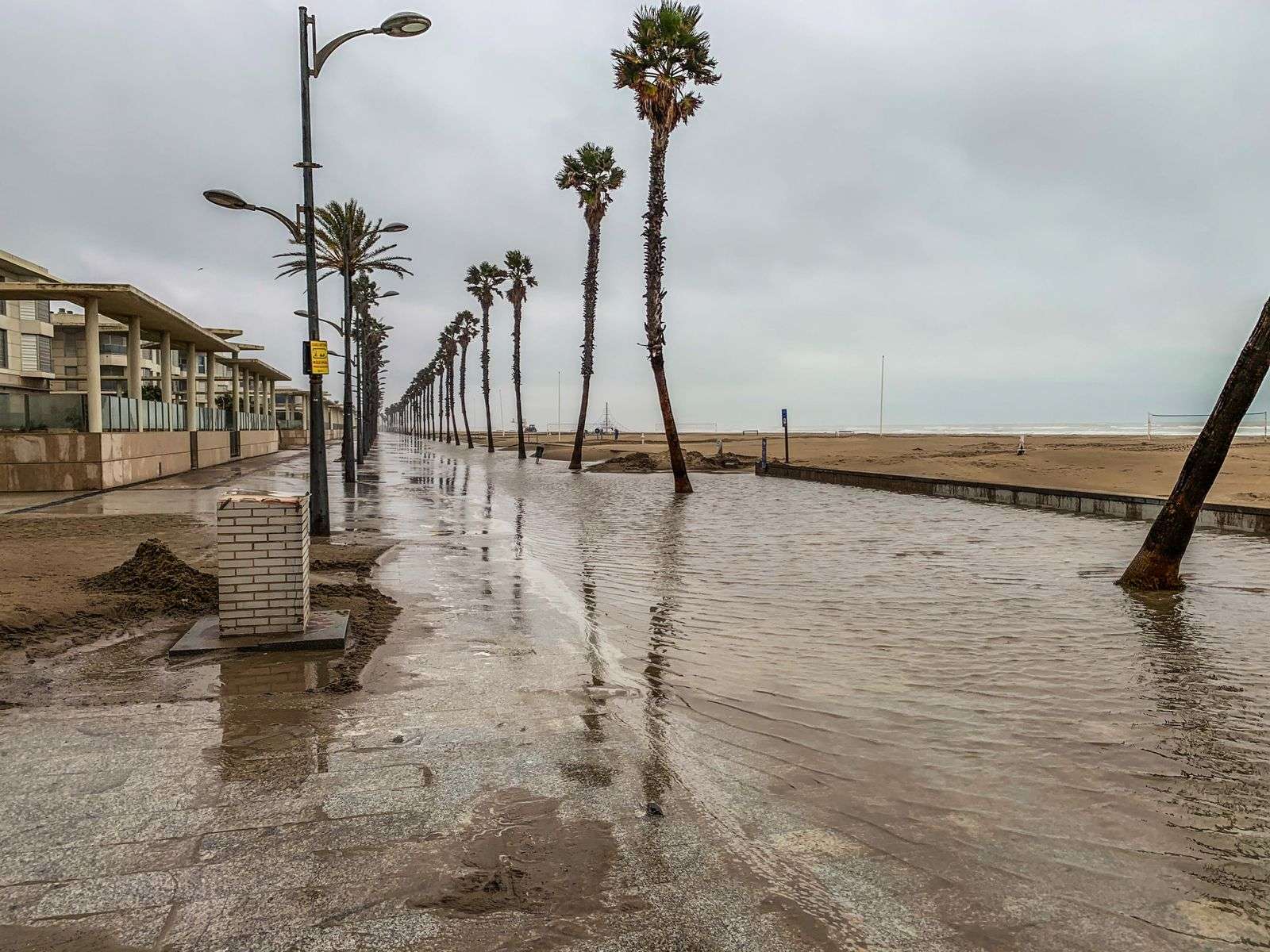
The National Weather Service has issued a Coastal Flood Advisory for Mobile Central and Baldwin Central Counties, in effect until 10 a.m. CDT Thursday. The advisory covers minor coastal flooding across the two central county zones, where forecasters say water could reach parking lots, parks and some roadways before conditions improve. Residents along Mobile Bay and its tidal tributaries will recognize the setup: elevated water levels pushed ashore by persistent onshore flow, arriving on top of the normal tide cycle.
Only isolated road closures are expected under this advisory level, but standing water may collect in low-lying, flood-prone spots — the familiar list of places that take on water whenever tides run high. Anyone who needs to travel while the advisory is active is advised to build extra time into their trip in case a route is affected, since a ponded roadway that takes five minutes to work around can cascade into delays across a morning commute.
The Weather Service is also urging residents in flood-prone areas to take steps now to protect property before water levels rise. Moving vehicles out of low driveways and lots, securing items stored at ground level, and checking that drainage paths around a home are clear are all measures that cost little in advance and save real money after the water drops.
What a Coastal Flood Advisory means
The advisory occupies a middle rung on the Weather Service’s ladder of coastal alerts. It is issued when minor flooding is expected — water over low-lying roads, into lots and lawns — but stops short of the moderate or major flooding that would trigger a warning. For most residents, an advisory means inconvenience rather than danger: wet shoes at the mailbox, a detour on the way to work, a parked car that should have been moved uphill. The key word in the language the Weather Service uses is “minor,” but the agency cautions that conditions can evolve, and advisories are upgraded when forecasts change.
Along the central Gulf Coast, coastal flooding typically develops when winds persist out of the south or southeast for long enough to stack water into Mobile Bay and the tidal rivers feeding it. When that onshore flow coincides with high tide — or, worse, with a new or full moon’s astronomically higher tides — water levels run well above normal and spill into the shoreline zones that sit only a foot or two above the waterline. The advisory’s Thursday morning expiration aligns with the point at which forecasters expect the combination to relax.
Where the water goes first
Anyone who lives near the bay can name the spots that flood first. In Mobile County, low-lying streets near the bay shoreline, tidal creeks and the rivers that drain into the bay collect standing water early, and the causeway across the northern end of Mobile Bay is a perennial candidate for water on the roadway when winds blow from the south. In Baldwin County, communities along the eastern shore and the tidal reaches of rivers and bayous see the same pattern, with yards, boat ramps and low sections of road taking on water hours before anything on higher ground is affected.
The advisory’s coverage of the “central” zones of both counties reflects how the Weather Service divides coastal Alabama for warning purposes: the central zones capture the heart of the Mobile Bay shoreline, where tide gauge readings and wind forecasts combine to drive these calls. Residents in the advisory zones are the ones most likely to see the minor flooding described, while those inland and on higher ground may notice nothing more than a stiff breeze off the water.
The cardinal rule: never drive through
Drivers should never go around barricades or attempt to cross water of unknown depth. The warning is standard in every flood advisory for good reason: it is the single most common cause of flood-related emergencies. Water across a road is deceptive in two directions at once. Depth is nearly impossible to judge, especially at night or in the rain, and the road surface beneath the water may already be undermined or washed out. A foot of moving water can float a small car, and even standing water of modest depth can hide a crater.
Along the coast, there is a third hazard that inland drivers sometimes forget: the water is salt water, moving with the tide, and it carries debris, oil, and the corrosion that follows vehicles for years after a flood encounter. Emergency crews in Mobile and Baldwin Counties respond each year to calls from drivers who attempted a flooded stretch that locals had already learned to avoid, and the advice the Weather Service repeats in every advisory — turn around, don’t drown — costs nothing to follow.
Barricades deserve special mention because they are placed by people who have seen the road at its worst. Going around a barricade is not a judgment call for individual drivers; it is a decision to ignore information gathered after the water rose. Officials place them at the locations with known history, and the small detour they impose is the cheapest insurance a driver will ever get.
Protecting property before the water rises
The Weather Service’s urging to act before water levels rise reflects how much difference a few hours of preparation makes in minor flooding events. Vehicles are the obvious first step: a car moved to a lot on higher ground keeps salt water out of its systems, and flood-damaged vehicles are among the costliest losses in otherwise minor coastal flooding. Ground-level storage, tools on garage floors, and items in low sheds should be lifted or relocated, and any drainage that crosses the property — ditches, culverts, yard drains — should be checked to make sure yesterday’s leaves are not damming today’s runoff.
Residents with repeated flooding experience usually have a routine down to a checklist: move the car, lift the stored items, photograph the property for insurance documentation, and then stay out of the water. That last point matters even in minor flooding, since coastal floodwater is a mix of bay water and whatever the streets contribute, and contact with it is not something to treat casually. Cleanup after the water recedes is a gloves-and-hose affair for anyone who has done it before.
Staying informed
Advisories like this one are issued and updated through the National Weather Service’s Mobile office, which covers coastal Alabama and northwest Florida and is the authoritative source for whether a coastal flood advisory will be extended past its 10 a.m. Thursday expiration or allowed to lapse. Forecasters there monitor tide gauges, wind observations, and the tide calendar, and they reissue or upgrade products as conditions warrant. Local emergency management agencies in both counties pass along the updates and handle the road-closure decisions that accompany higher water.
The expiration time is part of the message for a reason: coastal flooding in this region follows the tide, and conditions that are annoying at 9 a.m. may be gone by noon as the water drains back toward the bay. Until then, the advice stands — allow extra travel time, avoid the water, mind the barricades, and give the low-lying spots along the bay the respect they have earned from every past high-water event.
Why the central Gulf Coast floods so easily
The geography of Mobile Bay makes the region unusually sensitive to the wind. The bay opens southward to the Gulf, so water driven by south and southeast winds has a long fetch to build in before it reaches the shoreline — the same effect that makes a windy afternoon choppy for boaters also pushes the bay’s surface toward the northern and northwestern shores. Communities along that shoreline, plus the tidal stretches of the Mobile, Tensaw, Dog and Fish rivers, sit at elevations measured in single digits of feet above sea level, which means a tide that runs a foot or two above normal arrives as a visible problem rather than an abstraction.
Development patterns add to the exposure. Some of the region’s most scenic and historically desirable real estate sits on the water’s edge, and roads that serve it were laid out generations before flood mapping, in places where engineers of the era were more concerned with boat landings than storm surge. The result is a coastal zone where minor flooding is a recurring fact of life rather than a rare emergency — hence the routine character of advisories like this one, and the practiced way shoreline residents respond to them.
The tide calendar’s role
Astronomy sets the backdrop for every coastal flood event. Tides along the central Gulf Coast run higher at the new and full moons, when the sun and moon align in their pull on the water, and these “spring tides” can add several inches to the baseline before any weather factor is considered. When strong onshore winds arrive during one of those windows, forecasters at the Weather Service office can anticipate the combination with confidence, which is how advisories like this one get issued a day or more before the water is in the streets.
That predictability is useful for residents who pay attention to it. Boaters plan around high tide for ramp access, anglers know the tide tables better than anyone, and shoreline homeowners in flood-prone areas learn to glance at both the forecast and the moon phase. A minor flood advisory issued in advance is the system working as intended: the information arrives early enough that no one has to be surprised by a foot of water in the parking lot at daylight.
After the advisory ends
When the water recedes, the residue it leaves behind becomes the immediate nuisance. Salt water kills grass along the flooding margin, leaves a silt line across driveways and lots, and accelerates the corrosion of anything metal left in its path. Municipal crews in the affected zones typically check storm drains and clear debris washed in by the high water, and public works departments rely on residents to report blocked drains and standing water that lingers beyond the advisory period.
For most of the two central county zones, the Thursday morning expiration will end an event that amounts to a damp commute and a few wet lawns. The advisory’s practical value lies in that word “most”: the residents of the low-lying neighborhoods along the bay and its rivers, the ones the minor flooding actually reaches, get the hours of advance notice they need to move what matters and plan their travel. That is the whole purpose of the Coastal Flood Advisory as a product — small warnings, issued early, that keep routine tidal flooding from becoming anything worse.