

MOBILE, Ala. — The National Weather Service has stacked three coastal hazard alerts on top of one another for Mobile Coastal and Baldwin Coastal Counties, warning that rough Gulf waters will pose a serious threat to anyone near the shoreline into Thursday. The combination of large surf, minor coastal flooding and dangerous rip currents is the kind of multi-hazard setup that coastal officials treat with particular care, because each alert amplifies the dangers created by the others.
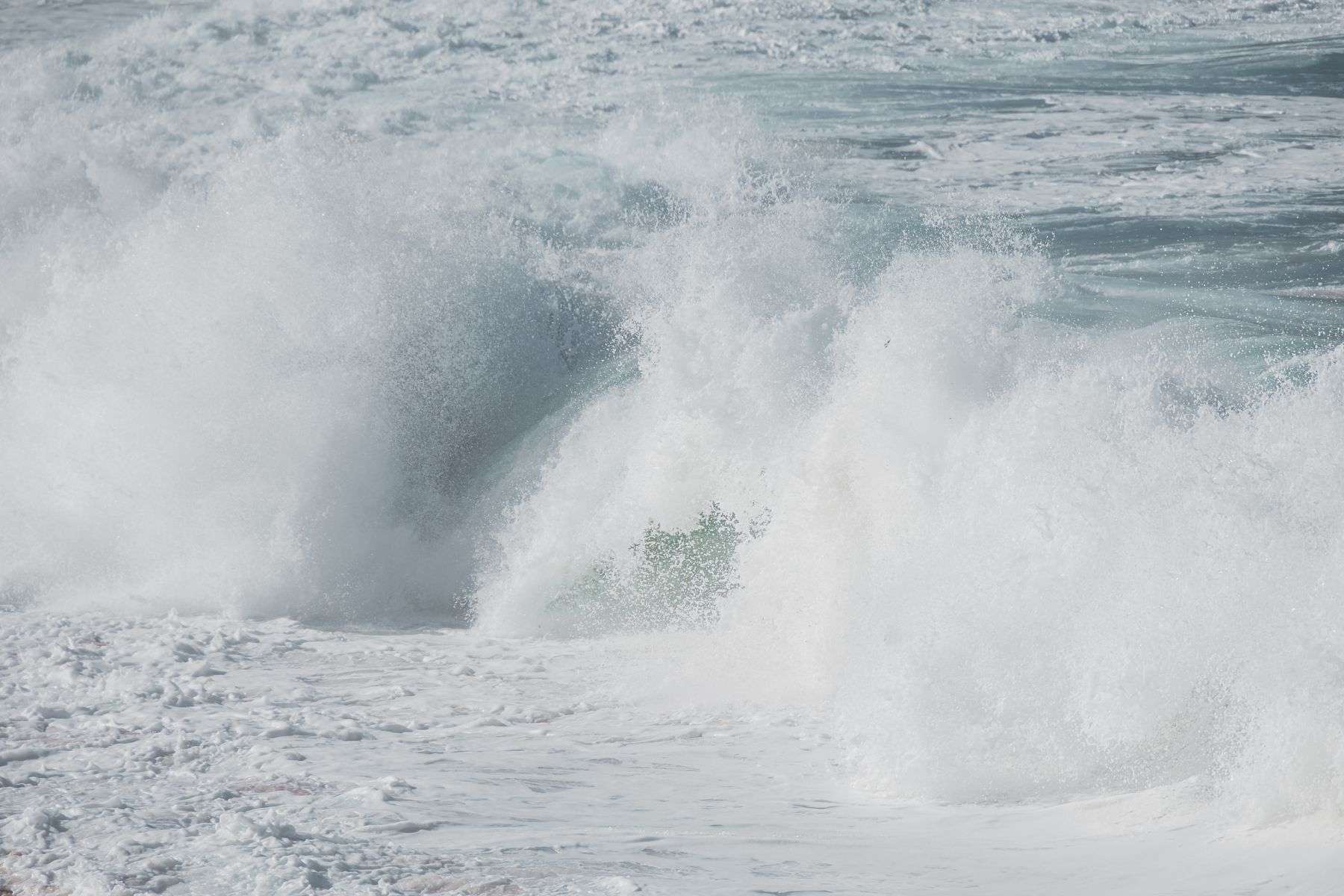
A High Surf Warning is in effect until 3 p.m. CDT Thursday, covering the same Alabama coastal zones as well as Escambia Coastal, Santa Rosa Coastal and Okaloosa Coastal Counties across the state line in Florida. Forecasters say breaking waves in the surf zone will run 6 to 10 feet, large enough to be dangerous for anyone in or near the water.
Waves of that size are far beyond what the Alabama Gulf Coast sees in typical summer conditions, when surf along the sugar-white beaches of Gulf Shores, Orange Beach, Dauphin Island and Fort Morgan usually runs to a couple of feet. Six-to-ten-foot breakers can push water over seawalls and dune walkovers, knock swimmers off their feet in knee-deep water and generate the violent near-shore currents that make rescues difficult even for equipped lifeguards.
Layered on top of that is a Coastal Flood Advisory, active until 10 a.m. CDT Thursday, for minor coastal flooding in the same area. A High Rip Current Risk rounds out the trio of alerts and remains in place through late Thursday night.
Forecasters expect the coastal flooding to reach parking lots, parks and some roadways, though only isolated road closures are anticipated. Minor coastal flooding of this type is a nuisance rather than a disaster for most property owners, but it creates hidden dangers of its own: saltwater ponding on roads can hide potholes and debris, vehicles stalled in standing water leave drivers stranded, and floodwater that reaches electrical systems or vehicles can create hazards long after the water recedes.
The bigger danger comes from the surf itself: breaking waves are strong enough to sweep people off jetties and docks and pull them into rough seas, and officials describe swimming conditions during the warning as life-threatening. Significant beach erosion is also expected as the large waves pound the shoreline.
The rip current threat adds another layer of risk for beachgoers. Even strong, experienced swimmers can be pulled away from shore into deeper water by rip currents, and officials are urging anyone heading to the beach in Mobile or Baldwin coastal areas to stay alert to changing surf and flag conditions through the end of the week.
Rip currents form when water piled up near the shore by waves and wind finds a narrow channel to flow back out to sea, typically through a break in a sandbar or alongside a pier or jetty. The currents can move faster than an Olympic swimmer can sprint, which is why fighting them directly is the mistake that turns a scary moment into a drowning. The standard advice — float, signal for help, and swim parallel to the beach until free of the current’s pull — works because rip currents are usually narrow, and a swimmer who stays calm and afloat is quickly carried out of the channel’s strongest flow.
The National Weather Service office in Mobile covers the Alabama coastal counties along with neighboring northwest Florida, issuing marine and coastal warnings from its forecast operations that serve beach communities from Dauphin Island east through Gulf Shores and Orange Beach and across Perdido Key to the Florida panhandle. During multi-alert events like this one, the office updates conditions in real time as buoys, tide gauges and beach observation networks report what the Gulf is actually doing.
Beach erosion from an event like this can reshape the coastline noticeably in a matter of days. The same waves that menace swimmers also pick up sand from the beach face and carry it offshore or down-current, cutting into dune lines and sometimes undermining boardwalks, crossovers and the foundations of beachfront structures. Baldwin and Mobile County beach communities periodically renourish their shorelines with dredged sand after erosive events, and public works crews spend the days following high-surf events clearing debris and assessing damage to public access points.
Residents and visitors near the coast are advised to avoid piers, jetties and other structures exposed to breaking waves, use caution around any standing water on roads and low-lying areas, and follow posted beach warning flags until all three alerts expire.
Why the alerts stack up together
The three alerts in effect share a common cause: a sustained stretch of onshore wind and swell driving Gulf water toward the coast. When wind blows steadily from the south or southeast for a day or more, it piles water against the shoreline, raising tide levels above normal — the ingredient behind the Coastal Flood Advisory — while simultaneously building the wave heights behind the High Surf Warning. Those same winds and waves stir up the near-shore circulation that produces rip currents, completing the trio.
Each alert carries its own geography and timing. The High Surf Warning, the most severe of the three, runs until 3 p.m. CDT Thursday. The Coastal Flood Advisory, focused on the high-tide windows when water piles highest against the shore, expires at 10 a.m. CDT Thursday. The High Rip Current Risk statement extends through late Thursday night, reflecting that dangerous currents linger even after the largest waves subside, because the sandbars and channels carved by the big surf keep funneling water seaward.
Meteorologists urge residents not to fixate on a single alert or a single hour. Conditions at the beach can change dramatically between morning and afternoon as tides rise and fall and the swell direction shifts, and a stretch of calm-looking water between sandbars is often precisely where a rip current is running strongest. Checking the latest forecast before heading to the shore — and again once there, by watching the flags flying at lifeguard stations and public beach access points — remains the most reliable protection.
What coastal residents should do
For people who live along the shoreline in Mobile and Baldwin counties, the practical steps are straightforward. Move vehicles out of low-lying parking areas that flood at high tide, secure loose items along the beachfront that large waves could carry away, and expect water on the lowest streets in flood-prone spots near the bay and the Gulf through the advisory period. Drivers should never drive through water of unknown depth, both because of hidden road damage and because saltwater in a vehicle’s systems is corrosive enough to total a car.
Boaters and anglers face their own cautions. Small craft face hazardous bar and inlet conditions when six-to-ten-foot surf is running, and fishing from a jetty or a surf-pounded point puts an angler within reach of waves that can sweep a person into the water with no easy way back to shore. Coast Guard and rescue crews across the northern Gulf respond to a cluster of such calls every time a high-surf event reaches the coast.
Swimmers get the simplest and most important instruction: stay out of the water while the High Surf Warning and High Rip Current Risk are in effect. Lifeguarded stretches of beach may display red or double-red flags signaling danger or closure, and entering the water against a double-red flag is a violation in Alabama’s beach communities as well as a serious risk to the swimmer and to the rescuers who would have to go in after them.
The flag system beachgoers should know
Alabama’s beach-flag program uses a uniform color code posted at public access points along the coast. Green means calm conditions, yellow signals moderate surf or currents and cautions swimmers to stay near shore, one red flag means high hazard with strong surf or currents, and two red flags flying together close the water entirely. A purple flag warns of dangerous marine life such as jellyfish or stingrays. During events like this week’s high surf, visitors should expect red and double-red conditions and plan beach days around sand, sun and sightseeing rather than swimming.
The flags are raised and lowered daily — and sometimes several times a day — by beach safety officials who combine the National Weather Service forecast with direct observation of the surf. In Orange Beach, the city’s surf rescue crews patrol lifeguarded beaches during peak season and respond to swimmers in distress; Gulf Shores operates a similar program along its public beaches. On Dauphin Island and at unguarded stretches of the Fort Morgan peninsula, no lifeguards are on duty at all, which shifts the entire burden of judgment onto visitors themselves.
That distinction matters during a High Rip Current Risk period. At a lifeguarded beach, a swimmer in trouble can be spotted and reached in minutes; at an unguarded beach, the rescue depends on a bystander seeing the problem, calling 911, and keeping the swimmer in sight until help arrives — a chain with far more links and far more chances to fail. Safety officials therefore urge anyone who must be near the water during hazardous conditions to do so only at guarded beaches, within sight of a lifeguard, and never alone.
The alerts were expected to expire on schedule Thursday evening, with surf and flooding conditions gradually easing behind them. Even after the flags drop back to yellow or green, officials advise lingering caution: channels cut through sandbars by this week’s large waves can persist for weeks, and the areas that produced strong rip currents during the event often remain the riskiest places to swim until the next significant sand movement reshapes the near-shore bottom.
Up-to-date alert information, marine forecasts and hourly surf predictions for the Alabama and northwest Florida coasts are available from the National Weather Service’s Mobile office, and beach conditions and flag status are posted daily by the coastal cities’ public safety and beach patrol departments.