Foley Flood Ordinance Would Add 150-Foot Floodway Buffer, Allow Stem Walls in Coastal Zones
Foley's City Council approved the first reading of a flood-damage prevention ordinance that adds a 150-foot floodway buffer, allows stem walls in Coastal AE zones and moves appeals to the Construction Board of Appeals. A final vote is expected in November.
FOLEY, Ala. — A proposed Foley flood ordinance would rewrite the city’s flood rules. The Foley City Council has approved the first reading of an ordinance that would tighten the city’s flood-damage prevention standards, add an elevation buffer along floodways, allow stem wall foundations in coastal flood zones and send flood-related appeals to a different board. A second reading and a final vote are expected in November.
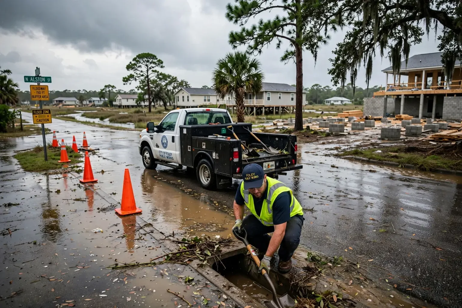
The proposal follows a wet start to October in south Baldwin County. Heavy rain flooded city streets on Oct. 4, days before Hurricane Isaias approached the coast, but city officials said no homes or other buildings were damaged. Mayor Ralph Hellmich credited ongoing drainage work, including city crews clearing ditches, for keeping water out of houses.
City leaders say the new ordinance is meant to build on that work by making sure new construction is elevated properly from the start, while also making Foley’s development rules clearer for the builders who have to follow them.
What the Foley flood ordinance would change
The proposed ordinance touches several parts of the city’s flood regulations. According to city officials, the main changes include:
- A 150-foot floodway buffer: Development within 150 feet of a mapped floodway would have to meet the flood elevation requirement that applies nearest to it.
- Stem walls in Coastal AE zones: Stem walls, which are foundation walls made of concrete or concrete block, would be allowed in areas designated as Coastal AE flood zones.
- A new name: The city’s Flood Damage Development Ordinance would be renamed the Flood Damage Prevention Ordinance, in line with terminology recognized by the Federal Emergency Management Agency.
- A new appeals route: Property owners who want to challenge a city decision on flood-damage prevention would take their appeal to the Foley Construction Board of Appeals instead of going directly to the City Council.
Hellmich said the changes would make the regulations easier to understand and help developers meet the elevation requirements the city expects.
“This gets us on a common-sense approach to addressing some issues that require them and helps the developers make sure they adhere to these elevations,” Hellmich said.
The mayor added that some contractors have already said they support the proposed changes.
A buffer along the floodway
The most significant technical change is the proposed floodway buffer. Jonathan Cottis, Foley’s chief building official and floodplain administrator, described how it would work.
“We’re looking to implement a 150-foot floodway buffer,” Cottis said. “Basically, if you’re within 150 feet of the floodway, you just have to meet the elevation requirement that’s nearest to it.”
In federal flood mapping, a floodway is the channel of a river or creek plus the adjacent land that must be kept clear so floodwater can pass without raising flood levels significantly. Floodways are typically the most hazardous part of a floodplain, where water moves fastest and deepest during a major flood. FEMA’s flood maps show floodways alongside the wider areas expected to flood during a “base flood,” the flood that has a 1% chance of happening in any given year, sometimes called the 100-year flood.
Each flood zone on those maps carries a base flood elevation, the height floodwater is expected to reach during that 1% annual chance event. Local rules then set how high the lowest floor of a new building must be relative to that elevation. Land just outside a floodway can sit close to a line where the required elevation changes, and the risk on the ground does not stop neatly at a mapped boundary. Under Foley’s proposal, property within 150 feet of the floodway would have to be built to the elevation requirement of the nearest zone, an approach intended to keep structures close to a floodway from being built lower than the nearby hazard warrants.
Stem walls and Coastal AE zones
The ordinance would also allow stem walls in areas designated as Coastal AE flood zones. A stem wall is a foundation wall built from poured concrete or concrete block that raises a building above the surrounding grade. Builders commonly use stem walls to lift a home’s first floor to the height required by flood rules.
Coastal AE zones are areas near the coast that are subject to flooding during a base flood and can also see moderate wave action, more than a typical inland flood zone but less than the high-velocity coastal areas FEMA labels as V zones. Construction standards in coastal areas are generally stricter than in other flood zones because waves and moving water can put extra force on foundations.
City officials noted that Foley’s adopted residential building code already allows stem walls in Coastal AE zones. The change would bring the city’s flood-prevention regulations into line with the building standards already in effect, removing a conflict between two sets of local rules that builders must follow.
Why the name and the appeals process matter
Renaming the Flood Damage Development Ordinance as the Flood Damage Prevention Ordinance may look like a small change, but city officials said it aligns Foley’s rules with terminology recognized by FEMA. “Flood damage prevention ordinance” is the standard name used by many communities for the local law that governs construction in flood-prone areas.
Those local ordinances are central to the National Flood Insurance Program, which FEMA manages. Communities that join the program agree to adopt and enforce floodplain management rules that meet at least the federal minimum standards. In exchange, property owners in those communities can buy federally backed flood insurance, and the communities stay eligible for certain kinds of federal assistance. Local governments may also adopt standards stricter than the federal minimum, and many coastal cities do.
The appeals change shifts where disputes are heard. Under the proposal, a property owner who disagrees with a city decision on flood-damage prevention would go before the Foley Construction Board of Appeals rather than taking the matter straight to the City Council. Construction boards of appeals typically hear challenges to decisions by a city’s building officials, and their members are generally chosen for experience in construction and building codes. Sending flood-related appeals to that board would place those cases in front of a body that already handles technical building questions.
Rain, ditches and Hurricane Isaias
The ordinance comes after a rough stretch of weather. On Sunday, Oct. 4, Foley received the equivalent of 2 inches of rain in about 20 minutes, according to the city. Intense bursts of rain like that can overwhelm drainage systems that are designed to move water steadily rather than all at once. Several city streets flooded that day, and the National Weather Service issued flash flood warnings for parts of southeastern Baldwin County. As South AL News reported at the time, City Engineer Taylor Davis described the downpours as “microbursts” that strained the drainage system.
Within days, the region was bracing for Hurricane Isaias. City crews worked around the clock to clear drainage ditches and reduce the risk of flooding before the storm arrived. Isaias ultimately turned east and came ashore near Destin, Florida, on Oct. 9 as a Category 2 hurricane, sparing coastal Alabama its worst effects.
Hellmich said the ditch work paid off.
“The big thing to take away from that is that the ditches are clean and at their maximum capacity,” Hellmich said. “We fixed things upstream and the houses along there are really not in jeopardy of flooding. That’s our goal, to make sure we don’t have houses that flood.”
The mayor’s comments point to a two-part strategy. Maintenance and drainage improvements help move water away from existing neighborhoods, while tougher construction standards help ensure that new homes and businesses are built high enough to stay dry when heavy rain does arrive.
Growth and flood risk in south Baldwin County
Foley is one of the fastest-growing cities in Alabama, part of a Baldwin County boom that has added new subdivisions, shopping centers and attractions across the southern end of the county. The city sits on generally flat, low-lying coastal terrain drained by creeks and rivers that flow toward Bon Secour Bay and the Gulf of Mexico. In that kind of landscape, new development can change how water moves across the land, and heavy rain has fewer places to go when ditches and channels are blocked or undersized.
That combination makes elevation rules especially important. A building constructed even a foot or two lower than the expected flood level can face repeated flooding over its lifetime, and flood insurance premiums under the National Flood Insurance Program are tied in part to how a structure’s elevation compares with the expected flood level. Clear, consistent standards help builders get elevations right the first time and can help protect future owners from costly damage.
Foley has made growth management a recurring theme. City leaders have discussed drainage, infrastructure and road projects as the population climbs, and the flood ordinance is one more piece of that effort.
What happens next
With the first reading approved, the ordinance is scheduled for a second reading and a vote on final passage in November. If the council adopts it, the new standards would apply to development under the city’s flood-damage prevention rules going forward.
For residents and property owners, a few practical points are worth keeping in mind:
- Builders and developers planning projects near floodways or in Coastal AE zones should review the proposed rules and check with the city’s building department, which handles floodplain administration, about how the changes could affect elevation requirements.
- Homeowners can look up their property’s flood zone on FEMA’s Flood Map Service Center website or ask the city’s floodplain administrator for help reading the maps.
- Anyone with questions or comments can attend Foley City Council meetings, which are open to the public, before the council takes its final vote.
Residents can also help reduce street flooding by keeping storm drains and ditches near their homes clear of yard debris and trash, and by reporting blocked drains or standing water to the city. During heavy rain, officials across the region repeat the same safety advice: never drive through flooded roads, because even shallow moving water can sweep a vehicle off the road.
For now, city leaders are pointing to the early October storms as evidence that Foley’s drainage work is paying off, and to the new ordinance as a way to keep the next generation of homes and businesses out of harm’s way.