Mobile Pursues National Historic Recognition for Auto Alley, Texas Hill
Mobile is seeking national historic status for two lesser-known areas: the old Automobile Alley on St. Louis Street and the Texas Hill community.
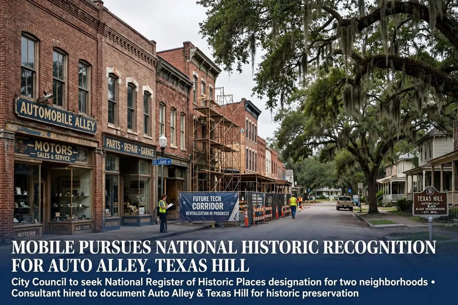
Two overlooked pieces of Mobile’s history could soon gain national recognition after the City Council agreed to pursue historic designation for the old “Automobile Alley” district and the Texas Hill neighborhood. The council’s resolution hires preservation consultant Shaun Wilson to prepare applications seeking a spot on the National Register of Historic Places for both areas. Automobile Alley refers to the stretch of St. Louis Street once lined with car dealerships, an area now targeted for redevelopment as a technology corridor and business park. Texas Hill is a historically Black neighborhood located just south of the Oakleigh Garden district.
The push comes as the city separately works on revitalization plans for both areas. An Atlanta-based planning firm was recently hired for close to $50,000 to develop a neighborhood revitalization strategy for Texas Hill, while the Auto Alley redevelopment concept has been in discussion for some time. Wilson’s work will also include expanding the boundaries of the existing Church Street East Historic District, surveying properties in the Lewis Quarter area and updating the city’s historic district maps. The consultant’s roughly $30,000 fee will be split evenly between the city and the Alabama Historical Commission.
What the Designation Means
The National Register of Historic Places is the federal government’s official list of districts, sites, buildings and structures deemed worthy of preservation, administered by the National Park Service in partnership with state historic preservation offices. Listing does not by itself restrict what a private owner may do with a property, but it brings tangible benefits: eligibility for federal and state historic tax credits for rehabilitation work, consideration in federally funded projects, and a formal documentation record that raises a district’s profile with investors, planners and visitors. For cities like Mobile, whose preservation infrastructure is already among the deepest in the South, National Register listing is often the first step toward leveraging private rehabilitation investment in neighborhoods that have seen little of it.
Mobile’s historic landscape is unusually rich. The city currently has ten locally recognized historic districts, including Leinkauf, Midtown, Lower Dauphin Street, Old Dauphin Way, DeTonti Square, the Campground, Oakleigh Garden and Church Street East. Two more, Oakdale and Lafayette Heights, were added to the national register in December 2014 and will soon appear on city maps as well. Each district represents a distinct chapter in the city’s 300-year history, from the antebellum mansions of Oakleigh Garden to the working-class neighborhoods that grew up around the port and rail lines.
Automobile Alley
The St. Louis Street corridor that became known as Automobile Alley rose with the automobile age itself. In the early decades of the twentieth century, as car ownership spread across the Gulf Coast, dealerships, service garages and parts houses clustered along the street near downtown, making it the region’s one-stop destination for buying and maintaining an automobile. Rows of showroom buildings with large display windows and repair bays defined the streetscape for decades, and many of those mid-century commercial structures survive today, their scale and masonry making them natural candidates for adaptive reuse as offices, studios and technology space.
That architectural stock is precisely what the city’s redevelopment vision contemplates. The Auto Alley concept envisions the corridor as a technology corridor and business park, drawing on the buildings’ open floor plans and proximity to downtown. A National Register listing would make rehabilitation projects along the strip eligible for historic tax credits, which preservation advocates have credited for much of the redevelopment activity in Mobile’s older commercial districts over the past two decades.
Texas Hill
Texas Hill, just south of the Oakleigh Garden district, is one of Mobile’s historically Black neighborhoods, with roots reaching back to the years after the Civil War when freed families established communities on the city’s periphery. Like many such neighborhoods across the South, it developed its own churches, schools and businesses, and its housing stock reflects generations of modest, well-built homes maintained by families who often owned the same lots for a century. The city’s decision to hire an Atlanta-based planning firm for close to $50,000 to develop a revitalization strategy for the neighborhood signals an intent to pair the historic designation effort with concrete planning work, addressing infrastructure, housing conditions and quality of life alongside preservation.
For historically Black neighborhoods, National Register recognition carries a significance beyond tax credits. Formal documentation of a community’s history — who built it, who lived there, what institutions anchored it — counters the erasure that redevelopment pressures often bring, and gives residents a documented claim to their neighborhood’s place in the city’s story. The applications Wilson prepares will compile that history through maps, photographs, deed research and interviews, creating a record that will exist regardless of what the future brings.
Lewis Quarter and the Clotilda
The survey work in the Lewis Quarter area may prove the most historically sensitive of all. Lewis Quarter, tucked behind an industrial lumber operation on Conception Street Road, carries particular historical weight tied to the Clotilda, the last known ship to bring enslaved Africans to the United States, which arrived in Mobile Bay in 1859. According to Wilson, the small community there was founded by a mixed group of freed African Americans and survivors associated with the Clotilda, distinct from the group that founded the nearby Africatown Historic District.
Much of Lewis Quarter’s historic significance is considered archaeological, centered on a small cemetery within the heavily wooded site. Any future historic designation would likely lean on that archaeological record, and state officials have indicated they may eventually want a ground-penetrating radar survey of the burial ground. Such surveys use radar pulses to map subsurface features without disturbing the soil, a standard technique for locating unmarked graves and confirming cemetery boundaries. The results would inform both the nomination and any future treatment of the site, and archaeologists regard the location as a rare surviving link to the Clotilda story that does not overlap with the better-known Africatown narrative.
The Clotilda’s story has drawn international attention since the ship’s remains were confirmed in the Mobile-Tensaw delta north of the city, and interest in the histories of the people it carried — and the communities their descendants built — has grown accordingly. Federal and state agencies, along with the Alabama Historical Commission, have invested in documenting related sites across the area, which is why the state agreed to share the cost of Wilson’s work. The roughly $30,000 fee, split evenly between the city and the Alabama Historical Commission, reflects that shared interest in getting the documentation right.
Preservation as Planning
City leaders say the historic designations, paired with ongoing redevelopment plans, are intended to preserve the character of these neighborhoods even as investment moves into the surrounding areas. The combination matters: designation alone does not revitalize a neighborhood, and revitalization without documentation can erase what made it distinctive. By pursuing both tracks at once — planning studies and National Register nominations — the city is attempting to make sure that growth in the Auto Alley corridor and around Texas Hill builds on the areas’ histories rather than replacing them.
The boundary expansion of the Church Street East Historic District and the broader map update round out the consultant’s scope. Historic district boundaries drawn decades ago often lag behind what scholarship and survey work now support, and periodic updates bring additional historically significant blocks into the formal record. For property owners, inclusion in a district can open the door to rehabilitation incentives, and for the city, accurate maps are the foundation for enforcement of design review and for planning decisions that respect each area’s character.
The National Register nomination process itself is methodical. A nomination requires a detailed description of the district’s buildings and boundaries, a statement of significance tying the area to patterns of history and architecture, and supporting documentation assembled into an application reviewed by the Alabama Historical Commission’s review board before being forwarded to the National Park Service for final listing. The process typically takes months, and the city’s investment in a consultant with Wilson’s experience reflects the technical demands of preparing nominations that can survive review.
For residents of Texas Hill and property owners along St. Louis Street, the immediate effect of the council’s action is the survey work now getting underway. Consultant crews will photograph and document buildings, research deeds and permits, and trace the ownership and development history of each block. The resulting nominations will tell the stories of the dealerships that lined Automobile Alley and the families who built Texas Hill, adding both areas to the formal map of Mobile’s history and setting the stage for the redevelopment and revitalization work the city has planned around them.
Preservation officials note that the three pieces of the consultant’s scope — the two new nominations, the Church Street East expansion and the Lewis Quarter survey — reinforce one another. A more complete historic map of the area south of downtown helps each individual nomination, and the documentation gathered for one application often supports the others. The council’s decision to bundle the work into a single contract keeps costs down and ensures a consistent research approach across the neighborhoods.