Orange Beach Launches $103,000 Traffic Study for Beach Road Safety
Orange Beach approved a $103,000 study to update traffic counts, upgrade signals, and improve pedestrian safety along Perdido Beach Boulevard.
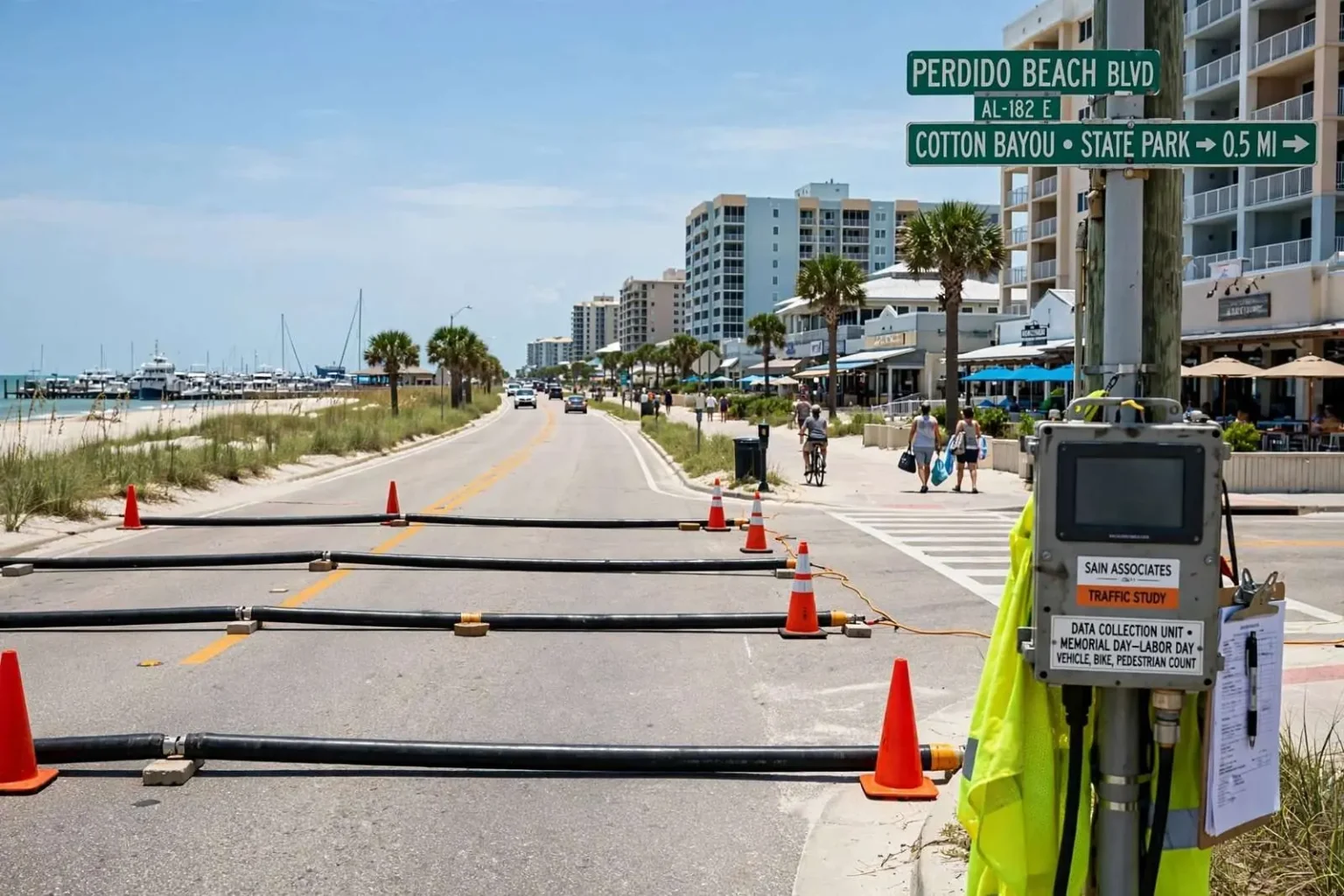
Orange Beach city leaders have set in motion a $103,000 traffic study aimed at easing congestion and improving pedestrian safety along the coastal city’s busiest corridor. The effort marks the city’s most comprehensive attempt in nearly a decade to understand — and plan for — the traffic that defines daily life in one of Alabama’s premier beach destinations.
The City Council authorized Mayor Tony Kennon to sign off on three task orders with Birmingham-based engineering firm Sain Associates to carry out the work. The study will focus on updating vehicle traffic counts across major roadways, developing a plan to modernize signals at 11 key intersections, and evaluating pedestrian safety upgrades along a five-mile stretch of Perdido Beach Boulevard, including a crossing near the state park’s Cotton Bayou beach access.
City officials said the last comprehensive traffic data for the area dated back to 2006, making it difficult to have informed conversations about current congestion levels. In the years since that count, Orange Beach has added condominium towers, restaurants, marina attractions and retail that have changed both the volume and the rhythm of traffic on the island, leaving planners working from a picture nearly a decade old.
Community Development Director Kit Alexander told council members that fresh numbers were essential before any real planning could begin, noting that traffic volumes have likely grown substantially since the last count. Alexander’s point gets at a practical problem for resort cities: investment decisions on signals, turn lanes and crosswalks are only as good as the data behind them, and bad data leads either to money spent in the wrong places or to projects that can’t win state or federal funding because their justification can’t be documented.
Data collection is set to begin over Memorial Day weekend, capturing patterns during peak summer travel, the Fourth of July, and Labor Day, along with quieter off-season periods for comparison. The deliberate pairing of holiday peaks with shoulder-season baselines reflects how differently Orange Beach functions through the year, when a city of a few thousand year-round residents absorbs a visitor population many times its size.
Counting cars, bikes and beachgoers
In addition to standard vehicle counts in both directions, the survey will track peak-hour turning movements at intersections as well as bicycle and pedestrian activity during high-traffic hours. Turning-movement data is the detail that drives intersection design — how many cars need left-turn arrows, how long pedestrian phases must run — while the bicycle and pedestrian counts address a safety picture that traditional traffic studies have often ignored.
Perdido Beach Boulevard — the coastal highway that serves as Orange Beach’s main street — carries some of the most complicated traffic in Alabama: tourists unfamiliar with the road, golf carts and bicycles sharing the corridor, pedestrians crossing to reach the beach, and locals trying to get to work through all of it. The five-mile study area takes in the length where those uses collide most frequently, and the Cotton Bayou crossing near the state park’s beach access is among the points where foot traffic and vehicle traffic meet most directly.
Pedestrian safety has grown as a public concern across the Gulf Coast’s beach communities, where visitors walk between condos, restaurants and the sand along highways that were designed primarily for cars. Improvements under consideration in such corridors typically include better-marked and signalized crossings, medians that give walkers a refuge mid-street, improved lighting and longer crossing times — measures that depend on accurate counts of where and when people actually cross.
The signal upgrade portion of the study will explore adaptive signal technology similar to systems recently installed along Alabama 59 in neighboring Gulf Shores, where traffic lights use radar to detect vehicle speed and spacing, then adjust timing in real time through a fiber-optic network. Gulf Shores’ experience on its own overcrowded beach highway has given Orange Beach a working model just up the road, complete with the lessons of installation, tuning and day-to-day operation.
Orange Beach officials indicated their approach could differ somewhat, potentially giving local police remote access to observe intersections and exploring a centralized system to keep signals synchronized during periods of heavy queuing. The idea of police visibility into the network speaks to a distinctly local problem: when an accident or an event snarls the corridor, the response today requires sending officers into the traffic jam itself, while a monitored system would let dispatchers see and manage the problem remotely.
Why 11 intersections
The 11 key intersections slated for modernization planning represent the decision points that govern flow across the city — the junctions where the beach highway meets the interior roads that feed condos, marinas, schools and the commercial districts. Signal modernization at those nodes can produce corridor-wide benefits, because travel time along a road is dictated by its worst constraints rather than its average segments.
The $103,000 study cost is modest against the price of the improvements it could unlock, and officials have framed it as the prerequisite step for competing for state and federal funding. Transportation grant programs routinely require documented counts, turning movements and benefit analyses before committing money, so the study functions as both an engineering tool and the city’s application portfolio for outside dollars.
Seasonal data collection carries its own methodology challenges, and the schedule built into the task orders reflects them. Memorial Day, the Fourth of July and Labor Day capture the extremes of peak demand, while off-season counts establish the baseline that shows what the road network must handle year-round. Together they will let engineers model not just average conditions but the worst-case weekends that define residents’ experience of the summer.
For the businesses along the corridor, the study’s findings cut both ways. Smoother signal progression and safer crossings tend to help commerce by making access easier, but any redesign that removes turn lanes or restricts left turns in front of restaurants and shops would draw scrutiny from owners who depend on drive-up customers. City officials have said the study process will identify problems before committing to solutions, giving stakeholders a chance to weigh in on specifics.
The pedestrian component has particular resonance for a city that has invested in promoting walkability as part of its brand. Orange Beach’s trail system and its efforts to connect attractions without cars have made the city a leader among Gulf Coast municipalities on non-motorized access, and the Perdido Beach Boulevard evaluation extends that work to its busiest and most dangerous setting.
What comes next
Once the counts are in and Sain Associates completes its analysis, the city will have a prioritized picture: which intersections fail worst, where pedestrian conflicts concentrate, and what combinations of signal upgrades, crossings and geometric fixes deliver the most relief per dollar. From there, funding decisions — local, and potentially through ALDOT and federal programs — will determine how quickly the recommendations become construction projects.
City leaders have been candid that no study will add pavement to the island or create shortcuts around geography; Orange Beach sits on a barrier strip with a fixed number of access points, and summer demand will always strain capacity. The realistic goal, officials say, is to make the existing network operate as efficiently and safely as possible — squeezing the wasted time out of the signal system and protecting the pedestrians who are part of what makes the city what it is.
With data collection beginning Memorial Day weekend, the city expects the study to run through the summer season and into the analysis and recommendations phase afterward. When it is complete, Orange Beach will hold something it has not had since 2006: a current, complete picture of its traffic, and a defensible basis for the projects and funding requests that follow.
The partnership with Sain Associates gives Orange Beach a firm with a long track record across Alabama municipal engineering, including signal design, corridor studies and the kind of seasonal-count methodology a beach community requires. Splitting the work into three task orders — counts, signal modernization planning and pedestrian safety — allows the city to proceed in stages and to budget each component distinctly as results come in.
Local officials have also connected the study to the city’s longer-range planning documents, which have called for improved corridor management as development continues. Condominium construction along the boulevard and continued growth of the Wharf and other entertainment districts add trips that ripple through the intersection network, and city planners want the traffic model updated so that future development reviews can measure impacts against real current conditions rather than 2006 estimates.
The collaboration with Gulf Shores on signal technology underscores a broader pattern of shared solutions along the coast, where the two cities face the same seasonal surges and often compare notes on tourism management, public safety and infrastructure. If Orange Beach proceeds with an adaptive system, coordination between the cities’ networks — particularly for traffic flowing down the corridor that connects them — would be a natural next step, giving both communities a clearer view of how congestion moves between them on peak days.