Tuesday Storms Knock Out Power to Thousands Across South Baldwin County
Afternoon thunderstorms cut power to more than 5,000 south Baldwin County customers and brought minor flooding and lightning damage.
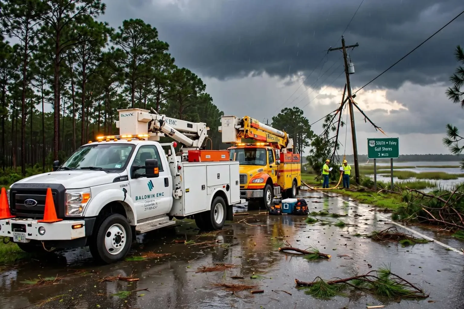
A fast-moving line of thunderstorms swept through south Baldwin County on the afternoon of Tuesday, September 16, 2014, knocking out electricity to thousands of homes and businesses and prompting a brief flood advisory for parts of the region. The storms arrived with little warning in the middle of a workday afternoon, and by the time the line had crossed the county, utility crews were working a restoration map that stretched from the Weeks Bay area all the way down to the beach communities.
The National Weather Service office in Mobile tracked the storm cell as it moved across the lower part of the county, with forecasters noting frequent lightning strikes and torrential rainfall between roughly 2 p.m. and 3:30 p.m. A photo shared by the weather service on social media captured the lightning-heavy system as it rolled over the area, giving residents a view of the storm from above even as they were watching it pass over their own neighborhoods.
The cell moved quickly, which limited how much rain fell on any single spot but concentrated the danger in a short window. Lightning-strike reports piled up as the line crossed the county, and the heaviest cells passed directly over some of the most populated parts of south Baldwin, where above-ground power lines run through a landscape of tall pines that regularly drop limbs during strong storms.
Thousands lose power across south Baldwin
Baldwin County Electric Membership Corporation reported that more than 5,200 customers had lost power by mid-afternoon, spread across roughly two dozen service areas stretching from Weeks Bay to Gulf Shores and Orange Beach. The scattered pattern was typical of a lightning-driven storm rather than a single downed line, forcing crews to chase individual trouble spots instead of repairing one main feeder.
A cooperative spokeswoman said crews were dispatched to nearly every affected area within the hour, and by later that afternoon more than 3,000 customers already had electricity restored. The pace of restoration reflected both the cooperative’s familiarity with summer storm damage and the fact that most of the outages involved localized equipment problems rather than destroyed infrastructure.
Riviera Utilities, which serves customers in and around Foley, reported a smaller but still significant outage, with about 1,000 customers losing service during the height of the storm. A utility spokesman said the vast majority of those customers, more than 900, had power back within a couple of hours. By early evening, only a few dozen customers remained without electricity, concentrated along U.S. 98 near Foley and in an area south of Fairhope.
The two utilities’ outage counts underscored how widely the storm’s effects were felt. Baldwin EMC is one of the largest electric cooperatives in Alabama, serving tens of thousands of members across Baldwin County from its base in Summerdale, while Riviera Utilities provides electric, water and other services to Foley and surrounding communities. A single fast-moving cell touching both systems at once left outage maps dotted with trouble spots from the bay to the coast.
Minor flooding, two lightning strikes
Baldwin County’s emergency management director said the storms produced only minor flooding along some county roads and portions of Highway 98 on the south end of the county, describing the water as a nuisance rather than a serious hazard. He also confirmed that lightning strikes were reported in at least two locations during the storm, giving the afternoon’s damage tally a pair of close calls alongside the widespread outages.
One strike produced a smoke smell inside a house, sending residents searching for a fire that never fully developed, while another ignited a small storage shed. Local fire crews were able to extinguish that fire quickly, and no injuries were reported from either incident. Fire officials regularly remind Baldwin County residents that lightning is among the coast’s most persistent warm-season hazards, and the two strikes on this afternoon showed how quickly a passing storm can touch individual homes even when the system itself is on the move.
As the storm system continued to move through the region, the National Weather Service issued a small stream flood advisory covering western Baldwin County and central Mobile County, which remained in effect into the early evening. Forecasters cautioned drivers to watch for standing water on low-lying roads even after the heaviest rain had passed, a familiar warning in a county where tidal roads and low bridges collect water quickly during heavy rain.
Restoration and lessons from a fast-moving storm
Utility crews in both service areas continued restoration work into the evening, and officials with both Baldwin EMC and Riviera Utilities said customers could track outages through each provider’s online outage maps. The rapid response from both utilities meant that the vast majority of affected homes and businesses had power restored well before nightfall, even as scattered pockets of outages persisted overnight in a few pockets of the county.
The September 16 storm fit a pattern that Baldwin County emergency managers know well. Gulf-front storms in late summer often arrive with little radar lead time, produce intense lightning and rainfall over a compressed window, and knock out power in scattered pockets that take longer to find than to fix. The county’s experience with tropical systems has built a restoration playbook that showed its value on a much smaller scale this week.
For residents, the episode was a reminder of how quickly conditions can change along the Alabama coast. A line of storms that crossed the county in little more than an hour knocked out power to more than 6,000 homes and businesses combined, started one fire, and left standing water on roads into the evening — and still, by the next morning, most residents had little to show for it but a handful of downed limbs and a utility bill cycle’s worth of outage notifications on their phones.
The flood advisory itself was brief, but it captured the two-county reach of the storm system. Advisories of that type are issued when creeks, streams and low-lying drainage areas are expected to approach or spill over their banks, and in western Baldwin County and central Mobile County the afternoon’s rain was enough to prompt the caution even though no serious flooding was reported. Residents in low-lying neighborhoods were advised to keep an eye on drainage ditches and small creeks, which rise fast in Gulf Coast downpours and fall just as quickly once the rain ends.
How the utilities tracked the damage
For both Baldwin EMC and Riviera Utilities, the afternoon’s work began with the outage management systems that log every call and every smart-meter signal into a live map of the service territory. During storms, dispatchers use those maps to group outages by probable cause and send crews to the largest clusters first, then work down to the single-household trouble spots as the afternoon wears on. That method is why some customers saw their lights return within minutes while others waited for a truck to appear in their neighborhood later in the evening.
Both utilities encouraged customers to report outages directly rather than assuming a neighbor’s call had already done the job, since each report helps confirm the extent of a problem area. The online outage maps, updated as crews work through the territory, have become the primary way coastal Alabama customers follow storm restoration without tying up phone lines.
A familiar September pattern on the Gulf Coast
Meteorologists with the Mobile weather service office note that September sits at the heart of the Gulf Coast’s storm season, when tropical moisture, daytime heating and passing disturbances combine to produce fast-developing afternoon storms. Cells that form over the Gulf or over inland Baldwin County can mature and cross the coast in less time than it takes to issue and read a warning, which is why forecasters lean heavily on social media and rapid alerts to get the word out.
The lightning-heavy character of the September 16 storm was consistent with that pattern. Strong summer and early fall cells over south Alabama routinely produce thousands of lightning strikes, and the National Weather Service’s photo of the system rolling over the county was a reminder of just how much electricity a single afternoon storm can carry.
What residents can take from the storm
Emergency managers use storms like this one as low-cost reminders of the basics. Keep flashlights and phone chargers where they can be found in the dark. Trim limbs away from service lines before storm season peaks. Treat every downed line as live, and every water-covered road as closed until proven otherwise. And when lightning is frequent, the safest place is indoors, away from windows and off corded electronics.
The restoration work that stretched into the overnight hours also served as a preview of the systems that will be tested again when a hurricane eventually takes aim at the coast. Crews that can restore power to thousands of customers in an afternoon are the same crews and mutual-aid partners that Baldwin County will depend on after a major storm, and each fast-moving cell like this one functions as a rehearsal.
By the following morning, the story of the September 16 storm was largely one of what didn’t happen: no injuries, no serious flooding, no lasting damage. But for the several thousand households that spent part of the afternoon without power, and for the fire crews who answered two lightning-related calls, the storm was a vivid reminder of how fast the Gulf Coast’s weather can turn an ordinary Tuesday into a small-scale emergency.