Remembering Hurricane Ivan 10 Years Later on the Alabama Coast
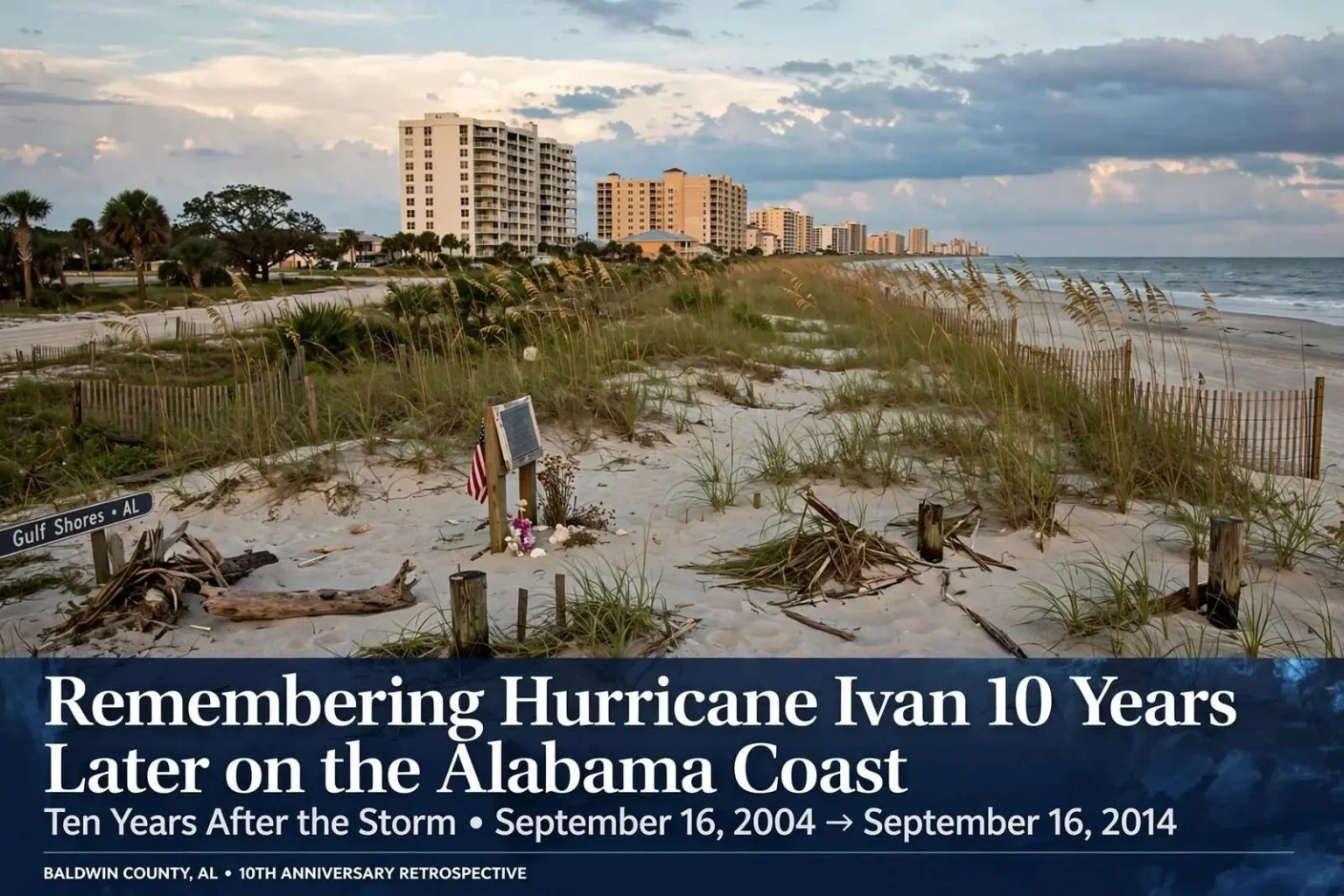
Ten years after Hurricane Ivan slammed into Baldwin County's beaches, the storm's record-setting surge and unusual second life still resonate along the Alabama coast.
Ten Years After the Storm
Ten years after Hurricane Ivan carved a path of destruction through coastal Alabama, life along the Gulf Coast has long since moved forward, but the storm’s mark on Baldwin County’s beaches and the broader region has never entirely faded from local memory. Condominium towers have been repaired, dunes have partially rebuilt themselves, and new construction has risen along the shoreline, yet longtime residents of Gulf Shores, Orange Beach, and the communities in between still speak of Ivan with a familiarity reserved for very few storms. For many of them, every hurricane season since 2004 has been measured against what Ivan did, how strong it was, and how quickly it arrived.
Ivan came ashore in the predawn hours of September 16, 2004, striking near Gulf Shores as a powerful Category 3 hurricane with sustained winds reaching 120 miles per hour. On the Saffir-Simpson Hurricane Wind Scale, a Category 3 storm carries sustained winds of 111 to 129 miles per hour and is classified as a major hurricane, capable of causing devastating damage even to well-built homes. Winds of that strength can rip off roofs, shatter windows, and snap or uproot large trees, and along the Alabama coast they downed power lines and left widespread outages that persisted for days across Baldwin and Mobile counties.
The wind, however, was only part of the story. An estimated 14-foot storm surge slammed into Orange Beach, nearly collapsing two beachfront condominium towers and burying homes and businesses along the coastline under mounds of displaced sand. Storm surge is often the most destructive element of a landfalling hurricane, produced as the storm’s winds and low pressure pile Gulf water onto the shore ahead of and alongside the eye. Along the Baldwin County beach communities, that wall of water scoured away dunes, undermined foundations, and pushed boats, debris, and sand far inland from the shoreline.
The scale of the surge damage left a lasting impression on longtime residents, many of whom still measure other storms against Ivan’s benchmark. In the weeks and months after landfall, crews worked to clear sand from roadways serving the beach communities, while property owners confronted the long process of rebuilding along a stretch of coastline where the storm had physically redrawn the landscape. Photographs from that era show condominium towers with balconies sheared away and stretches of beach road buried beneath drifts of sand carried in from the Gulf.
Ivan’s approach had been watched for days along the entire northern Gulf Coast, and the storm’s eventual track, shifting in the final hours before landfall, concentrated the destructive right-front quadrant on the Baldwin County beaches. That kind of late shift is a familiar feature of Gulf hurricanes, and it is one reason emergency managers in both counties continue to urge residents to prepare for a storm stronger and larger than the forecast suggests rather than fixating on a single projected landfall point.
A Storm That Refused to Die
What made Ivan especially unusual was its refusal to simply dissipate after landfall. After crossing the southeastern United States, the storm’s remnants pushed out into the Atlantic, and forecasters assumed its life cycle had ended. But less than a week later, on September 22, 2004, the National Weather Service identified a low-pressure system swirling over the Gulf of Mexico as the revived remains of Ivan. The regenerated system came ashore again the following day as a tropical depression near Cameron, Louisiana, a second act that earned Ivan a reputation as the storm that simply would not die.
The rebirth of a hurricane’s remnants after they have crossed land and moved out over the open Atlantic is rare in the historical record, and a regenerated system that then loops back into the Gulf of Mexico is rarer still. Tropical systems depend on warm water and organized circulation to survive, and most remnants that survive a passage over land quickly lose their structure over the varied terrain of the interior Southeast. Ivan’s remnants managed to hold together long enough for September’s warm Gulf waters to revive the circulation, an outcome that caught even experienced forecasters off guard and required the National Hurricane Center to resume issuing advisories on a storm most had already written off.
By the numbers, Ivan ranks among the more significant hurricanes in Atlantic Basin history. Meteorologists rank it tied for 10th among the most intense Atlantic hurricanes on record, based on a minimum central pressure of 910 millibars, a mark it shares with a 1924 storm that struck Cuba. Central pressure is one of the most reliable measures of a hurricane’s overall intensity: the lower the pressure at the storm’s center, the more powerful the circulation surrounding it, and readings below 920 millibars place a storm in extraordinarily rare company in the Atlantic basin.
In terms of overall damage, Ivan ranks sixth among the costliest Atlantic hurricanes, with total losses estimated at roughly 18.8 billion dollars, trailing storms like Hurricane Katrina, which caused an estimated 108 billion dollars in damage. Cost rankings reflect the value of what lies in a storm’s path as much as the storm’s raw strength, since a weaker hurricane striking a densely developed coastline can do more monetary damage than a stronger one moving through open water or lightly populated areas. Even so, Ivan’s position high on the cost list a full decade after landfall is a measure of how much destruction the storm spread across the Caribbean, the Gulf Coast, and the eastern United States.
Despite its power, Ivan was not primarily remembered as a deadly storm. Of the 54 deaths attributed to the hurricane across the United States, 14 occurred in Florida, with the remainder scattered across the storm’s broader path. That relatively modest toll, given the storm’s size and reach, reflected decades of improvements in forecasting, evacuation planning, and construction practices along the Gulf Coast. Residents in coastal Alabama and the Florida Panhandle had days of warning before landfall, and large portions of the population moved inland ahead of the storm, well before conditions deteriorated.
Three Weeks on the Water
Ivan’s full life cycle stretched across more than three weeks. The system began as a tropical depression on September 2, 2004, strengthened into a tropical storm the following day, and reached hurricane strength by September 5. It made its first landfalls in Grenada on September 7 and Jamaica on September 10, before reaching peak intensity as a Category 5 storm on September 12 with a central pressure of 910 millibars. A Category 5 storm, the top of the Saffir-Simpson scale, carries sustained winds of 157 miles per hour or greater, and only a small fraction of hurricanes that form in the Atlantic each year ever reach that threshold.
Ivan’s track across the Windward Islands and the central Caribbean carried it over some of the warmest ocean waters in the Atlantic basin, fueling the rapid intensification that carried it to Category 5 strength. Grenada and Jamaica both absorbed direct strikes that damaged homes, infrastructure, and agriculture, and the storm went on to brush Cuba before turning north into the Gulf of Mexico. For Gulf Coast residents tracking the storm from work and home in early September 2004, Ivan’s steady march across the Caribbean offered nearly two weeks of notice, an unusually long lead time that shaped the evacuation decisions communities faced as the storm approached the northern Gulf.
After brushing Cuba on September 13, Ivan made its U.S. landfall near Gulf Shores in the early hours of September 16, weakening to a tropical depression later that same day. Its remnants briefly seemed to fade by September 18, only to reemerge as the revived system that struck Louisiana on September 23, before finally dissipating for good on September 24. Forecasters tracked the system through every one of those transitions, and the episode became a case study in how long-lived tropical cyclones can confound assumptions about where and when a storm’s life truly ends.
The regenerating remnant brought additional heavy rain and gusty winds to coastal Louisiana and the upper Texas coast, areas that had escaped the worst of Ivan’s original landfall but now faced the storm a second time. The name Ivan itself was subsequently retired from the rotating list of Atlantic storm names, an honor accorded only to hurricanes that prove particularly destructive or deadly, ensuring that no future storm will carry the same name.
A Decade of Rebuilding and Remembering
A decade on, the storm remains a touchstone for coastal Alabama residents who lived through it, from the businesses that rebuilt along Orange Beach and Gulf Shores to families who still recall the sand, debris and displaced structures left behind once the water finally receded. The rebuilt beachfront that visitors see today bears little outward resemblance to the battered shoreline of September 2004, and the recovery that produced it unfolded over years rather than months, as insurance claims, construction schedules, and tourism cycles all shaped the pace at which each property came back.
For emergency management officials in Baldwin and Mobile counties, Ivan’s anniversary serves as an annual reminder that major hurricanes can and do strike the Alabama coast directly, contrary to a persistent belief among newer residents that the state is somehow spared the worst of Gulf storms. The middle of September marks the historical peak of the Atlantic hurricane season, the point at which sea surface temperatures in the tropical Atlantic and Gulf of Mexico reach their annual maximum and conditions are most favorable for storms like Ivan to form and intensify.
Residents who ride out Ivan in 2004 came away with hard-earned lessons about preparedness that continue to circulate each time a storm threatens the coast: keep fuel in vehicles well before landfall, plan for days without power, secure important documents, and never assume that a storm’s forecast landfall point will hold. Ten years later, those lessons, along with the memory of a 14-foot surge and a storm that would not stay dead, remain part of the shared experience of living along the Alabama Gulf Coast.