

The Alabama Historical Commission is beginning a sweeping new survey of the Mobile River aimed at locating and cataloging shipwrecks and other submerged cultural resources along the waterway, with the ultimate goal of creating a National Register Maritime Historic District. The project could also help investigators track down the wreck of the Clotilda, the last known ship to bring enslaved Africans to the United States.
The announcement follows the conclusion of a separate investigation earlier this year. In March, the Historical Commission worked alongside the National Park Service, the Smithsonian’s National Museum of African American History and Culture, and the maritime archaeology firm SEARCH Inc. to examine a shipwreck discovered in January in Baldwin County waters. After detailed testing of the vessel’s construction and architecture, researchers determined that wreck was not the Clotilda.
The disappointment of that finding sharpened rather than diminished the case for the new survey. Each vessel eliminated from consideration narrows the search, and the Mobile River — the dark, sediment-laden waterway that runs through the heart of the city — has long been regarded by archaeologists as the most likely resting place of the schooner that carried 110 captive Africans to Mobile in 1860 before it was scuttled to hide the crime. A systematic map of the riverbed serves both goals at once: the careful documentation of every historic vessel the river holds, and the patient elimination of candidates in one of the most emotionally significant underwater searches in America.
What state law requires
State law charges the Alabama Historical Commission with managing and protecting shipwrecks and other archaeological sites found in Alabama’s waters, a responsibility that includes identifying cultural resources scattered across the state’s rivers, bays and coastline. Officials say the new Mobile River project grew directly out of that mandate, as well as the intense public interest generated by the search for the Clotilda.
That mandate is broader than many residents realize. Alabama’s submerged lands hold everything from prehistoric canoes and colonial-era vessels to steamboats, barges and warships, and the agency is charged with knowing what is down there before erosion, dredging, construction or looting destroys it. Rivers are particularly fragile archives: low-oxygen mud can preserve hulls for centuries, but channel work, bridge construction and storm surge can erase them in an afternoon. An inventory is the precondition for protection — a wreck cannot be shielded from harm if no one has recorded that it exists.
The National Register Historic District concept adds a formal framework to that work. A maritime historic district along the river would recognize a concentration of significant underwater resources as a single listed area, giving the wrecks a measure of recognition and review that scattered, unlisted sites lack. For a city whose economy was built on the river, the district would also be a statement about what Mobile’s waterway means: not just a working channel, but a layered record of three centuries of Gulf Coast history.
How the survey will work
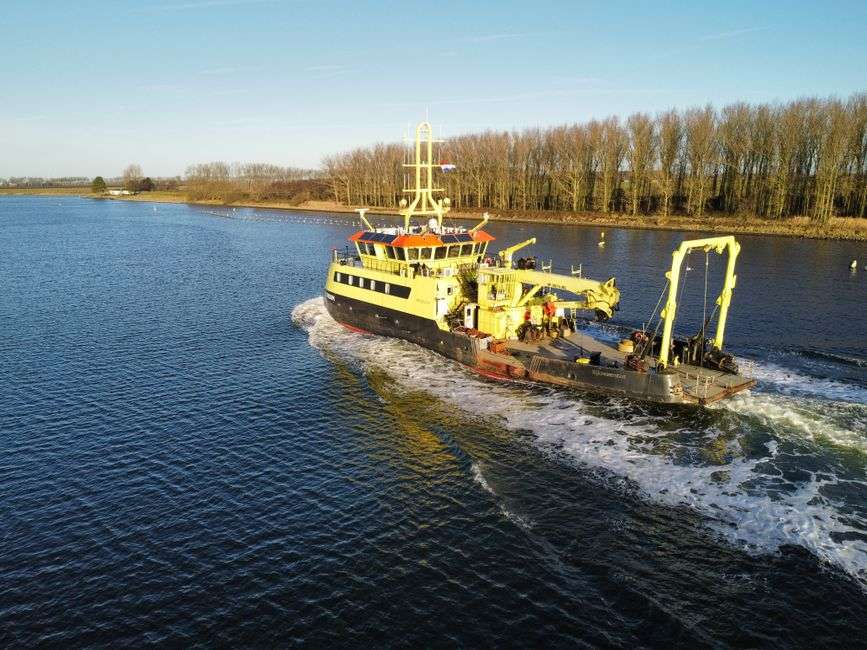
To carry out the work, the Historical Commission has contracted SEARCH Inc. to conduct a Phase I remote-sensing survey designed to locate significant submerged cultural resources along the river. Crews will deploy advanced maritime equipment, including a marine magnetometer, side-scan sonar and a sub-bottom profiler, to map the riverbed and detect anomalies that could indicate shipwrecks, structures or other historic material buried beneath sediment.
The three instruments do complementary work. The magnetometer towed behind a boat detects disturbances in the earth’s magnetic field caused by iron — engines, fasteners, fittings, cargo — that reveal a metal vessel even when mud swallows it whole. Side-scan sonar paints a picture of the riverbed itself, showing hull shapes, obstructions and debris fields on or near the bottom. The sub-bottom profiler looks deeper, using sound pulses to image sediment layers and flag buried materials that neither of the other tools can reach. Run together across miles of river, they produce something the Mobile has never systematically had: a geophysical map of its own underwater history.
From data to decisions
Once that data is collected, SEARCH archaeologists will analyze the findings and compile a report that includes a description of the area’s prehistoric and historic context along with a full inventory of the resources identified. The report is where a pile of sonar returns becomes usable history: each anomaly gets a location, a description and an assessment of its likely significance, and the most promising targets are ranked for future investigation.
Phase I surveys are deliberately non-invasive — no dredging, no excavation, nothing disturbed. Divers and test excavations belong to later phases, reserved for sites that justify the cost and risk. That staging matters on a river like the Mobile, where sediment, currents and commercial traffic complicate any hands-on work, and where the state’s first priority is simply knowing where things are. The inventory produced this year becomes the roadmap for every decision that follows: what to protect, what to study, and what to leave undisturbed on the riverbed.
Why the Clotilda search continues
The Clotilda occupies a place in Alabama history unlike any other vessel. The schooner was bought and fitted out in 1860 by a Mobile businessman making an illegal final voyage of the trans-Atlantic slave trade, decades after such importation had been outlawed. Its 110 African captives were smuggled up the river, the ship was burned and sunk to conceal the evidence, and the survivors — freed at the end of the Civil War — founded their own community north of Mobile, which became known as Africatown. Descendants of those families live in Mobile to this day, and the search for the wreck has been conducted with their history at the center of it.
The vessel examined in March, discovered in January in Baldwin County waters across the bay from the search area, was tested on precisely those grounds: construction details, materials and architecture were measured against what is documented about the Clotilda’s build and working life. The determination that it was not the schooner was definitive, and the January discovery has since taken its place as an interesting wreck in its own right rather than the answer to the search.
What the episode demonstrated, and what officials hope the survey builds on, is how the collaboration worked. The Historical Commission brought its legal authority over state waters, the National Park Service and the Smithsonian brought federal expertise in maritime and African American archaeology, and SEARCH Inc. brought the field capability to investigate a wreck quickly and thoroughly. The Mobile River survey is the same partnership applied at river scale — and it is the mechanism by which any future candidate wreck can be evaluated with the same rigor the Baldwin County site received.
The river as an archive
Maritime archaeologists have long considered the Mobile River one of the most significant unexplored underwater landscapes on the Gulf Coast. The river and its bends served as the terminus of every voyage into the city, a mooring ground for steamboats, a graveyard for vessels abandoned when their working lives ended, and a channel where Civil War-era activity left its mark. Because much of the river bottom has never been systematically surveyed, even the basic inventory of what lies there remains open — which is exactly what a Phase I survey exists to change.
The project also arrives at a moment of growing public attention to Alabama’s submerged heritage. The story of the Clotilda and Africatown has drawn international coverage, and communities along the river have watched dredging and development reshape the waterway with an eye toward what might be lost. A documented, listed maritime district would give that public interest a durable institutional home: maps, reports, protections and a recognition that the river bottom is a historical record belonging to the state and its citizens.
What it means for Mobile residents
For people living along the river and in the neighborhoods that border it, the survey is likely to be visible before it is tangible. Survey crews operate from boats running consistent search patterns, tow their instruments low and slow, and repeat lines to distinguish real targets from noise. Commercial traffic continues throughout; the work is designed to fit around the river’s working life, not interrupt it. Residents may also see divers and support vessels in later phases if significant targets are found near shore.
The longer-term implications reach into heritage tourism and education. A registered maritime historic district, backed by a published inventory, gives Mobile a story to interpret — riverboat era, Civil War activity, the African diaspora story centered on Africatown — with documented sites rather than legend alone. Cities across the country have built museums, walking trails and classroom programs around listed underwater resources, and Mobile’s combination of a dense wreck record and a nationally significant narrative gives it unusual material to work with.
Protection is the quiet benefit that historians tend to mention first. Once resources are inventoried and a district established, agencies reviewing dredging permits, bridge work or waterfront construction have a legal basis to require consideration of what lies beneath. The river will keep serving its commercial role — that is not in question — but future projects will proceed with the river’s history on the record instead of hidden in the mud.
A patient kind of archaeology
Nobody involved expects the survey to answer the Clotilda question on its first pass. Remote sensing identifies targets; confirming what a target actually is requires divers, measurements, archival research and time, exactly the process that played out over months on the Baldwin County wreck. The value of a Phase I survey is that it converts an open-ended search into a structured one, replacing rumor and guesswork with a map that succeeding investigations can refine year by year.
That patient structure suits the subject. The vessels the river has taken were not lost in a single event but over centuries of commerce, war and abandonment, and the record they left is uneven — some hulls well preserved in anoxic mud, others scattered or buried beyond detection. The Historical Commission’s approach acknowledges that: document everything, protect what is found, and let the significance of each discovery emerge from evidence rather than expectation.
The survey stands, finally, as a statement about what Mobile chooses to remember. A city that has poured its fortune in and out of this river for three centuries is committing resources to see what the river kept — the ships that carried cotton, the hulls that carried people, the material traces of a Gulf Coast story that ended mostly out of sight. Whether the Clotilda is among the findings or not, the map that emerges will be the fullest record yet of what the Mobile River holds, and the foundation for every search, study and protection decision that follows.