

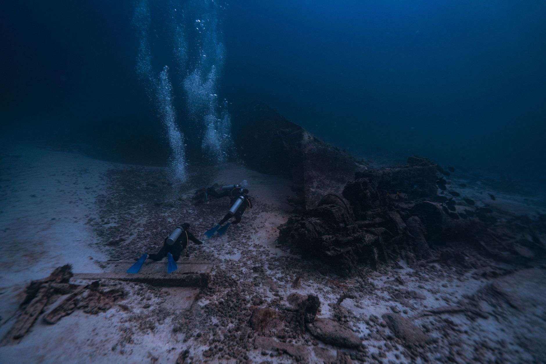
The Alabama Historical Commission and a team of maritime archaeologists have wrapped up a week-long underwater survey of the Mobile River, capping off an effort to catalog the waterway’s many shipwrecks while continuing the search for the Clotilda, the last known ship to carry enslaved Africans into the United States.
The survey, which concluded July 13, covered a four-mile stretch of the river with overlapping survey lines that together totaled more than seventy miles of boat runs.
It was carried out under contract with the Historical Commission by SEARCH Inc., a maritime archaeology firm with experience on cultural resource projects around the world, and supported by the National Geographic Society.
The scale of the operation reflected the difficulty of the water. The Mobile River is a working industrial channel whose dark, sediment-laden water gives divers little to no visibility, and its bed holds layer upon layer of sunken vessels from a century and a half of shipping, shipbuilding and salvage. Rather than dive blindly, the team mapped from the surface, running instrument transects back and forth across a four-mile reach — more than seventy miles of cumulative track lines — to build a picture of what lies on and beneath the riverbed. Each run of the boat added another strip of data, and overlapping passes let analysts distinguish a genuine anomaly from sensor noise.
National Geographic’s involvement included a field team led by archaeologist Dr. Fredrik Hiebert, along with an electronics technologist, a photographer and videographer, and a writer who documented the work.
The Historical Commission’s State Archaeologist, Stacye Hathorn, also took part, along with Kamau Sadiki of the Slave Wrecks Project, a partnership between George Washington University, the Smithsonian Institution’s National Museum of African American History and Culture, and the National Park Service.
Sadiki, who also dives with the group Diving with a Purpose, was part of the team that examined a separate wreck near Baldwin County earlier this year that was ultimately ruled out as the Clotilda.
“Searching for the Clotilda is a significant step in restoring historical memory, and reconnecting the descendant communities of Africatown and Benin,” Sadiki said of his participation in the survey.
Other partners in the project included the Alabama Department of Conservation and Natural Resources, the City of Mobile, and the Mobile County Commission.
Officials also credited John Sledge, senior architectural historian for the Mobile Historic Development Commission, and Harbor Master Terry Gilbreath for their help during the fieldwork.
The breadth of that partner list says something about how the Clotilda search has evolved. What began as an archaeological question has become a civic undertaking — a project in which the state’s historic preservation agency works alongside the city, the county, conservation authorities, a global exploration society and descendant-community representatives. The river itself is managed territory, and surveys on it require coordination with the agencies that control the waterfront, the pilots who move vessels through the channel and the industries whose operations border the survey area.
Why the river holds so much history
Crews used a magnetometer to detect the iron mass of sunken hulls and machinery, paired with sonar and subsurface instruments that could picture wrecks buried under decades of sediment.
A magnetometer reads disturbances in the earth’s magnetic field caused by ferrous material — iron fasteners, engines, chain, boilers — which makes it the standard first instrument for locating wrecks in zero-visibility water. Sonar paints the shape of whatever sits above the mud, while sub-bottom profiling sees through it. Together the instruments produce a catalog of targets: positions, sizes, orientations and estimates of burial depth. From that catalog, archaeologists decide which anomalies deserve verification by roving or diving — and which are pipe, cable, modern debris or natural objects.
The Mobile River’s stretch through the city has collected wrecks since steamboats first worked the Alabama River system in the early nineteenth century. Fires, collisions, storms and simple abandonment left hull after hull in the channel and along its banks, and the river’s industrial present — tugs, barges, docks and salvage operations — has only added to the layering. Every survey of the waterway has therefore returned a longer list of targets than the search for one vessel would require, and each cataloged wreck adds to the historical record of the port that made Mobile an American gateway to the Gulf.
The Clotilda and Africatown
The stakes of the search are unique in American archaeology. The Clotilda was a schooner that, in 1860, on the eve of the Civil War and half a century after the international slave trade had been outlawed, carried a final illegal cargo of African captives across the Atlantic to Mobile. After unloading the captives upriver, the parties behind the voyage burned and scuttled the vessel to destroy the evidence of their crime. The survivors of that voyage, freed after the Civil War, founded their own community north of Mobile — Africatown — the only settlement in America established and continuously occupied by Africans brought over through the illegal trade.
The community’s founders kept their memories alive in stories, in family names, and in a graveyard and church that still anchor the neighborhood’s identity. Their descendants today form the descendant community whose partnership Sadiki described — a connection that reaches across the Atlantic to the West African coast from which the captives were taken, in the region of present-day Benin. That link between Africatown and Benin is why the search is framed not only as a hunt for a hull but as an act of restoring historical memory: identifying and protecting the vessel would give the community a tangible anchor for a story passed down through five generations.
The hunt has been methodical precisely because the river offers so many candidates. In the years before this survey, researchers examined multiple wrecks in and around the Mobile-Tensaw delta, including the Baldwin County-area wreck that Sadiki’s team inspected earlier in the year and that archaeological review ruled out as the Clotilda. Each eliminated candidate narrows the field, and the instrument-based cataloging of the four-mile river stretch was designed to replace speculation with measurement: every iron mass on that reach now has a documented location, dimensions and burial estimate, from which the Clotilda — if it lies there — must be distinguished by its specific size, form and construction.
The instruments themselves were operated under conditions that test both equipment and crews. Tidal exchange with the bay moves the river’s current back and forth through the day, commercial traffic requires coordination before any station work, and the sediment load that gives the water its opacity also accumulates over wrecks at rates that vary along the reach. Running more than seventy miles of lines in a week meant long days on the water, precise navigation so that each pass aligned with the last, and continuous logging of positions — the unglamorous discipline on which every later conclusion depends.
The coordination with local officials proved essential to the week’s work. Harbor Master Gilbreath’s office controls the practical realities of the working river — berthing for the survey vessel, scheduling around commercial movements and the waterfront knowledge that comes from years of managing traffic on the channel. Sledge’s contribution ran in the other direction, from the historical record: decades of research into Mobile’s waterfront and its documented wrecks, which helps analysts interpret what the instruments find. Projects of this kind succeed or fail on exactly such combinations of institutional knowledge, and the survey team credited both men for keeping the operation moving.
SEARCH Inc., the firm contracted for the survey, brought a portfolio of comparable work to the job. Maritime archaeology firms of this kind operate across the Gulf, the Atlantic and abroad, documenting wrecks for government agencies, port authorities and cultural institutions, and their value in a project like this lies in translating raw sensor data into defensible archaeological findings. The National Geographic Society’s documentation team, meanwhile, will turn the fieldwork into the photography, video and written record that carries the story far beyond Mobile — an outreach dimension the Clotilda effort has leaned on heavily as public interest in the vessel has grown nationwide.
What comes next
A survey of this kind ends with analysis rather than answers. The team’s data must be processed, targets prioritized and the most promising anomalies selected for closer inspection, which can involve probing the sediment, roving with divers in limited visibility windows, or targeted excavation under permits and with descendant-community involvement. The Historical Commission’s approach throughout the Clotilda work has emphasized verification before announcement — a discipline shaped by earlier episodes in which premature identification of a Mobile River wreck as the Clotilda had to be walked back.
Whatever the instruments reveal, the survey has already produced a lasting public benefit: the first systematic map of a historically dense four-mile reach of one of Alabama’s principal rivers. The catalog of wrecks it yields will inform future preservation decisions, guide any diving that follows, and stand as a record of the vessels — steamboats, barges, workboats and perhaps one burned schooner — that the Mobile River has taken in over nearly two centuries of commerce. For Africatown and its partners in Benin, the hope remains that somewhere in that catalog is the hull their histories have kept alive since 1860.