Extreme Heat Warning, Heat Advisories Persist Across Gulf Coast as Atlantic Tropics Quiet Down
A first-ever Extreme Heat Warning for central Alabama and a continuing coastal Heat Advisory keep dangerous heat in place across the Gulf Coast, even as Atlantic tropical activity quiets down.
Update: Extreme Heat Warning Issued for the Coast Tuesday
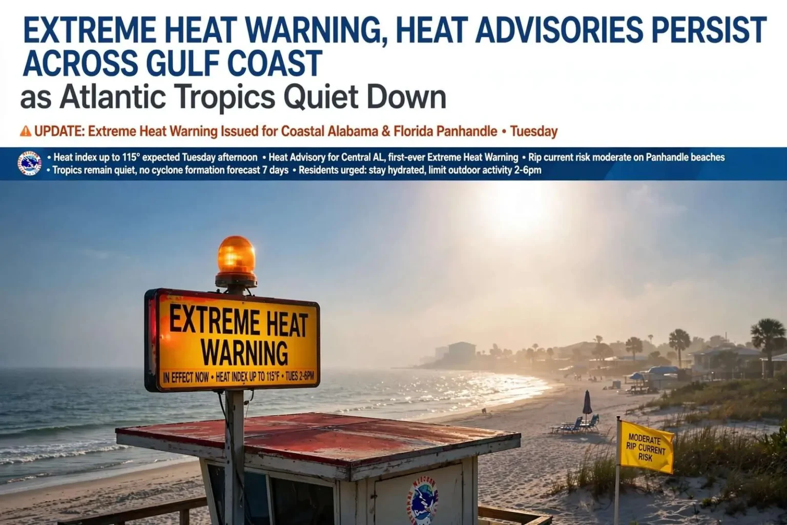
The threat escalated further Monday night, as the National Weather Service issued an Extreme Heat Warning for areas along and south of Interstate 10 in Southwest Alabama and the Florida Panhandle — including Grand Bay, Mobile, Foley, Stapleton, Orange Beach, Pensacola, Pensacola Beach, Gulf Breeze, Navarre and Destin — with heat index values expected to reach as high as 115 degrees Tuesday afternoon. Forecasters say heat index readings above 110 degrees create a real risk of heat-related illness, and they’re urging residents to limit outdoor activity between 2 and 6 p.m., when the heat is most intense.
Other recommended precautions include staying in air conditioning or seeking out a public cooling center, drinking water throughout the day rather than waiting until thirsty, wearing light-colored and loose-fitting clothing, and checking on elderly neighbors and others who may be more vulnerable to the heat. There is a bit of a silver lining: scattered showers and storms could develop late Tuesday afternoon and evening, bringing around a 40 percent chance of rain that may offer some spotty relief, though not everyone will see rain.
The dangerous heat is expected to continue through Tuesday and into Wednesday before easing later in the week, as an upper-level ridge shifts westward and a trough pattern brings better daily chances for showers and storms, along with more comfortable temperatures heading into the weekend. The tropics, meanwhile, remain quiet. Forecasters say tropical storm formation is not expected over the next seven days, with dry air and strong upper-level winds across the Atlantic Basin keeping conditions calm.
Heat Advisory Continues as Central Alabama Sees First-Ever Warning
Dangerously hot weather continued to grip South Alabama and Northwest Florida on Monday, as the National Weather Service kept a Heat Advisory in effect for the Gulf Coast and, for the first time ever, issued an Extreme Heat Warning for central Alabama.
The advisory covers late morning through the evening, with afternoon heat index values along the coast expected to climb into the 105- to 112-degree range, and forecasters say additional heat alerts are likely through the middle of the week. The National Weather Service office in Birmingham issued the Extreme Heat Warning for all of central Alabama beginning at 9 p.m. Sunday, marking the first time that office has ever used the warning category, which was added to the agency’s alert system in 2025. An Extreme Heat Warning is issued when “extremely dangerous heat conditions are expected,” and forecasters said the heat index in parts of central Alabama could reach as high as 113 degrees.
Overnight temperatures are not expected to drop much either, which can compound heat stress for residents without air conditioning. Sunday’s heat pushed several cities well above normal for mid-August, with Mobile reaching 97 degrees while Tuscaloosa hit 101 and Montgomery reached 100 — readings five to ten degrees above the seasonal average.
Along the coast, overnight lows are running warm as well, generally holding in the mid to upper 70s inland and near 80 degrees along the immediate shoreline, offering little overnight relief before the next hot afternoon. The extended stretch of heat has built steadily since the middle of last week, when the Gulf Coast first fell under a Heat Advisory with heat index values reaching 108 to 110 degrees. Afternoon highs settled into the mid-90s through the weekend, with humidity regularly pushing the heat index past 108 degrees and occasionally toward 112. Rain chances have stayed low, offering little natural relief, though isolated to scattered afternoon thunderstorms remain possible each day and could produce locally strong wind gusts, heavy rainfall and frequent lightning.
Rip Current Risk Rises
Beachgoers should also be mindful of rough surf. The rip current risk increased to moderate along Pensacola-area and other western Florida Panhandle beaches beginning Monday and is expected to continue through the middle of the week, meaning life-threatening currents are possible even for strong swimmers. Alabama beaches were being monitored but remained at a lower risk as of Monday. Swimmers are urged to check local beach flags and swim near a lifeguard whenever possible.
Health Officials Urge Precautions
Local health officials are urging residents to take the heat seriously. “Heat injury is serious, but it is also preventable,” said Dr. Kevin Michaels, Health Officer for Mobile County, whose department has been sharing heat-safety guidance as the advisories have stacked up. “With heat indices above 100 degrees over the next several days, small steps such as drinking water, taking cooling breaks, and planning around the hottest hours of the day can protect you, your family, and your coworkers.”
The Mobile County Health Department recommends drinking water regularly rather than waiting until thirsty, taking breaks in shade or air conditioning, wearing lightweight and light-colored clothing, and checking on older adults, young children and outdoor workers who face greater risk. Officials also stressed that children and pets should never be left in a parked vehicle, even briefly, since interior temperatures can rise to life-threatening levels quickly.
Relief Expected Later in the Week
There are signs of change later in the week. Forecasters expect temperatures to ease back into the lower to middle 90s by the weekend as increasing moisture and instability bring better chances for afternoon and evening thunderstorms, particularly Saturday. The National Weather Service is forecasting a return to more typical late-summer heat by Friday, with highs in the lower 90s rather than the upper 90s.
In the tropics, activity has calmed after a busier stretch earlier in the week. Forecasters had been tracking Tropical Depression Cristobal, which weakened and dissipated over the open Atlantic, along with additional disturbances, including one in the central tropical Atlantic that briefly showed signs of organization. By the weekend, however, the National Hurricane Center said it was not expecting any tropical cyclone formation across the North Atlantic, Caribbean Sea or Gulf of Mexico over the next seven days. Forecasters say there is no immediate tropical threat to the Gulf Coast, though they will continue monitoring the basin as the season moves toward its historical peak in the coming weeks.
What the Heat Alerts Mean
The heat index combines air temperature and relative humidity to estimate how hot it actually feels, because humid air slows the evaporation of sweat that normally cools the body. The National Weather Service calculates heat index values for shady, light-wind conditions, so time in direct sunshine can make conditions feel as much as 15 degrees hotter than the posted number.
The Extreme Heat Warning took its current name in March 2025, when the Weather Service renamed its former Excessive Heat Warning and Excessive Heat Watch as part of an effort to simplify its hazard alerts. A Heat Advisory remains the lower-tier alert, issued when heat is expected to be dangerous but not severe enough to meet warning criteria, which vary from one region to another.