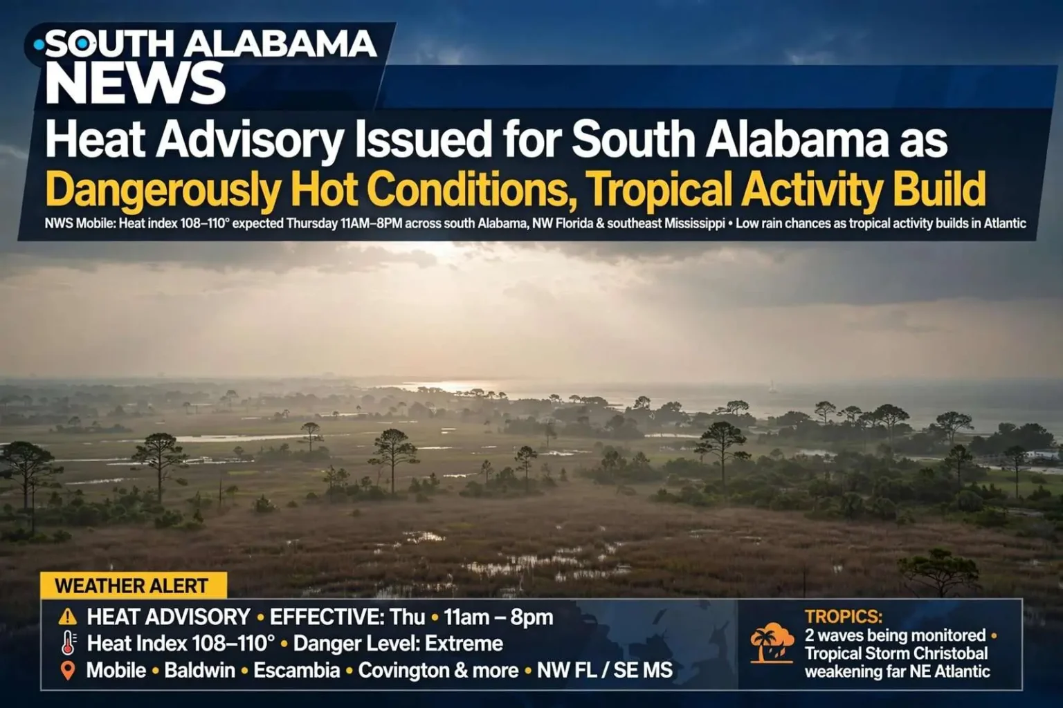
The National Weather Service in Mobile has issued a Heat Advisory for a wide swath of south Alabama, northwest Florida and southeast Mississippi, warning that dangerously hot conditions will make it unsafe to be outside for extended periods. The advisory takes effect at 11 a.m. and runs through 8 p.m. Thursday, with heat index values expected to reach between 108 and 110 degrees. The announcement puts the central Gulf Coast in the grip of the kind of heat event that public health officials rank among the region’s most dangerous weather threats, precisely because it builds gradually and catches residents who underestimate it.
The affected area includes Mobile, Baldwin, Escambia, Choctaw, Washington, Clarke, Wilcox, Monroe, Conecuh, Butler, Crenshaw and Covington counties in Alabama, along with portions of the Florida Panhandle and southeast Mississippi. The footprint covers essentially all of south Alabama west of the Florida line and stretches north through the piney woods counties, touching every major population center in the Mobile forecast area. Communities under the advisory include Mobile, Daphne, Foley, Fairhope, Bay Minette, Gulf Shores, Orange Beach, Dauphin Island, Saraland, Prichard, Monroeville, Evergreen, Andalusia and Brewton, among many others, a list that spans from the beaches to the Black Belt fringe.
A heat index of 108 to 110 degrees is dangerous by any measure. The index combines air temperature and humidity to describe how hot conditions feel to the human body, and readings in that range mean the body’s cooling mechanism, the evaporation of sweat, becomes markedly less efficient. Prolonged exposure or exertion at those levels can push internal body temperature into the danger zone in a matter of hours, and health officials treat heat advisories at this level as a genuine medical warning rather than a comfort notice.
Forecasters say the heat is only beginning to build. Daytime heat index values are expected to climb into the low 90s Thursday, then jump into the upper 90s by Saturday and Sunday, with heat index readings again nearing 110 degrees both days. Next week could bring even more intense conditions, with actual air temperatures approaching 100 degrees and heat index values topping 110 degrees through the middle of the week. The progression describes a pattern residents of the central Gulf Coast know well, in which a dominant summer ridge parks over the region and locks hot, humid air in place for days at a stretch, offering little overnight relief.
Rain chances remain low across the region, with only isolated showers expected to offer brief relief. Afternoon thunderstorms, usually the region’s pressure valve in the summer months, are forecast to be scarce, which means clouds and rain-cooled air will provide little interruption to the heat. Overnight low temperatures that stay unusually warm compound the danger, because the human body recovers from daytime heat stress only when nighttime temperatures fall enough to allow rest, and extended runs of hot nights are a hallmark of heat events that produce illness.
How to Stay Safe
The National Weather Service and the Occupational Safety and Health Administration are urging residents to take the heat seriously. Recommended precautions include drinking plenty of fluids throughout the day and staying in air-conditioned spaces when possible, limiting strenuous outdoor activity to early morning or evening hours, wearing lightweight, loose-fitting and light-colored clothing, and taking frequent breaks in shaded or air-conditioned areas, especially for anyone working outdoors. The agencies also stress checking on elderly relatives, neighbors and anyone without reliable access to air conditioning, since the elderly, the very young and people with chronic illness account for a large share of heat deaths every year.
Outdoor workers face the sharpest exposure. Construction crews, roofers, landscapers, farm workers and delivery drivers across the region will be on the job through the advisory window, and federal workplace guidance calls for employers to provide water, rest and shade on a schedule that increases as temperatures climb. The pattern known as heat acclimatization matters too: workers who are new to outdoor jobs are at elevated risk during their first weeks, and employers are urged to ease new hires into full workloads during extreme heat. For the region’s many outdoor industries, from the port to the shipyards to the farms of the interior counties, the advisory period will test routines that have been refined over many summers.
Athletics programs across south Alabama also adjust during advisories of this kind. School fall practices, youth league workouts and outdoor recreation routinely shift to early morning hours, with coaches and athletic trainers watching for signs of heat illness that can develop quickly in adolescent athletes. The first weeks of football practice each August coincide with the most dangerous heat of the year, and schools across the advisory area have protocols for shortened practices, mandatory water breaks and immediate response when a player shows symptoms.
Officials stressed that heat stroke is a medical emergency. Anyone who becomes overcome by heat should be moved immediately to a cool, shaded location, and bystanders should call 911. The distinction between heat exhaustion and heat stroke matters for anyone responding: heat exhaustion brings heavy sweating, weakness and nausea and calls for cooling and fluids, while heat stroke, marked by confusion, hot dry skin or loss of consciousness, is immediately life-threatening and requires emergency medical care without delay. Public safety officials repeat that calling 911 first costs nothing and saves lives.
Tropics in the Background
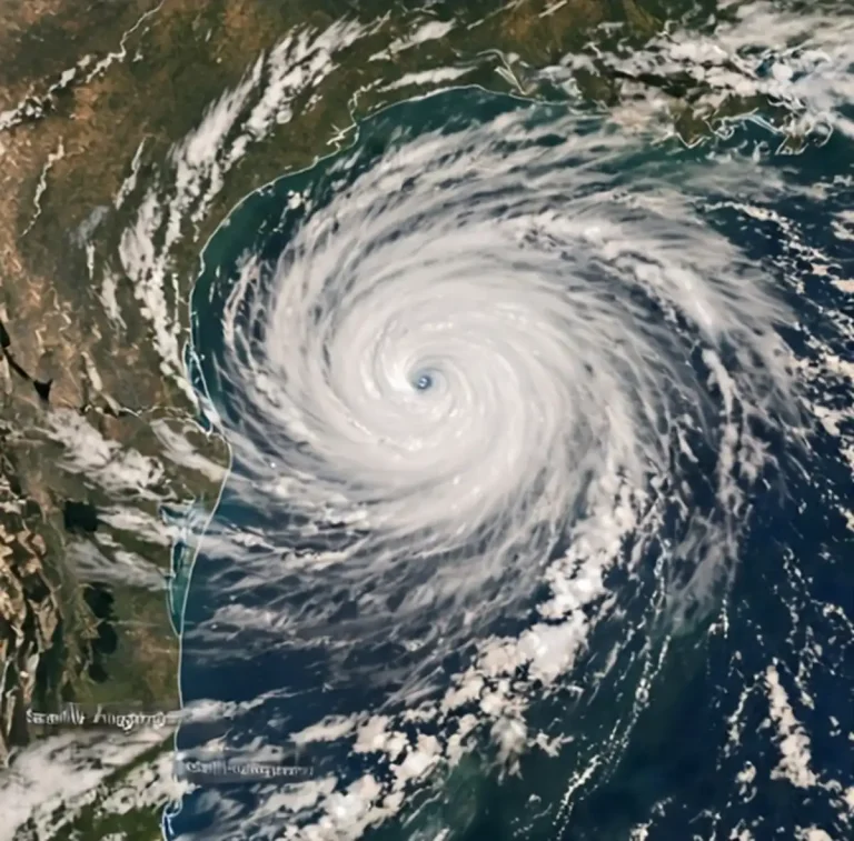
The heat wave is developing as forecasters track increasing tropical activity in the Atlantic. Tropical Storm Christobal is currently spinning in the northern Atlantic on a track toward the Azores; as it moves over cooler waters, it is expected to weaken rapidly over the next 24 hours and poses no threat to the Gulf Coast. The storm’s fate is a routine late-season story, a system that formed over open ocean and will dissipate against cold water long before any coastline is involved.
However, the National Hurricane Center is monitoring two additional tropical waves that forecasters say carry a greater potential to affect the region as the Gulf Coast moves deeper into the heart of hurricane season. The calendar is entering the stretch of late summer when tropical development in the Atlantic basin most often threatens the northern Gulf Coast, and the combination of a locked-in heat ridge and active tropics is a familiar August pattern. Residents are reminded that the same season that brings heat advisories brings the need for hurricane preparedness, and households that have not yet reviewed supplies and plans are encouraged to do so during the quieter stretches between systems.
For now, the immediate task is getting through the heat. The advisory window from 11 a.m. to 8 p.m. Thursday covers the hottest part of the day, but forecasters caution that the broader pattern will persist well beyond any single advisory, with the most intense heat still ahead early next week. Residents should expect additional advisories or warnings as the pattern builds, and officials urge everyone to treat the first advisory of a heat wave as the signal to adopt the precautions that will be needed all week long.
South Alabama News will continue to monitor both the heat advisory and tropical development and provide updates as conditions change. Updates from the National Weather Service in Mobile, including any extensions of the advisory or new advisories covering the weekend and early next week, will be reported as they are issued. In the meantime, the guidance for the region is simple: hydrate, limit outdoor exposure, check on those most vulnerable, and treat a heat index pushing past 110 degrees with the same seriousness that Gulf Coast residents bring to any other severe weather threat.
Heat advisories carry particular weight along the northern Gulf Coast because of the region’s humidity. Coastal air holds moisture that the afternoon sun pumps into the atmosphere, and it is the dew point as much as the temperature that determines how dangerous a given day becomes. A 95-degree afternoon in a dry climate is uncomfortable; the same reading on Mobile Bay with Gulf moisture in place can push the heat index past the advisory threshold. That humidity also means that shade and fans, while helpful, are poor substitutes for air conditioning during an event like this one, and public cooling options become important resources for residents without it.
Utility demand climbs as air conditioning runs around the clock, and extended heat waves strain the electrical grid across the Southeast. Power providers ask customers to conserve during peak afternoon hours where possible, and outages during extreme heat are treated as emergencies requiring rapid response, since a home without air conditioning can become dangerous within hours. Residents using fans are reminded that fans alone do not prevent heat illness when the heat index climbs this high, and that moving to an air-conditioned space, even for a few hours, is the recommended strategy for those without it at home.