
Storms Drench Northwest Florida, Flooding Streets and Damaging Property
Storms swept through Northwest Florida late Wednesday, flooding streets and damaging property as the Gulf Coast's late-summer storm pattern continues.
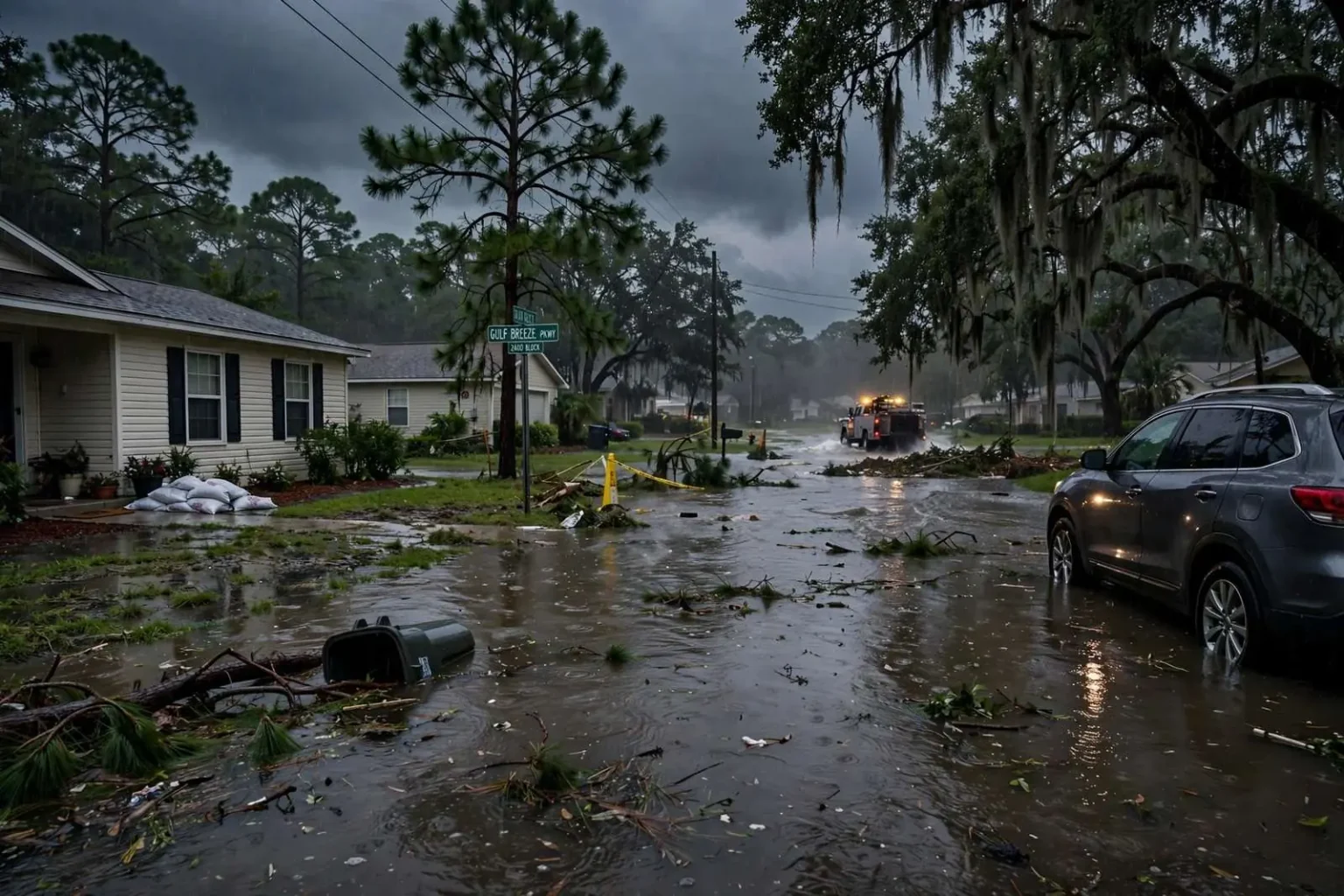
A line of storms swept through Northwest Florida late Wednesday afternoon, dumping heavy rain that quickly overwhelmed streets and left property owners across the region assessing damage. The fast-moving system pushed across the Panhandle during the evening commute, turning thoroughfares into shallow rivers and stranding vehicles in low spots before the water finally began to recede after dark. No widespread injuries were reported, but the burst of rain left a familiar aftermath: clogged culverts, waterlogged yards and owners of homes and businesses documenting what the water took with it.
The fast-moving system produced localized flooding in low-lying areas, a common hazard along the Gulf Coast, where flat terrain and saturated ground can turn a short burst of intense rainfall into standing water on roadways within minutes. Unlike a hurricane’s broad sweep, these summertime lines of storms concentrate their rainfall on a few neighborhoods at a time, which makes the damage highly uneven — one subdivision floods while the next stays dry — and makes cleanup a street-by-street affair rather than a single regional effort.
Northwest Florida’s coastal cities are built on ground that gives water nowhere quick to go. The region stretches from Pensacola and the beach communities of Escambia County east through Navarre, Gulf Breeze and Milton in Santa Rosa County, a landscape of low ridges, marshy depressions and barrier islands separated by the bays and sounds of the Pensacola Bay system. Rain that falls miles inland drains slowly toward those bays, and when the rain comes faster than ditches, curbs and storm drains can carry it, the water simply sits until gravity and evaporation catch up.
A Familiar Late-Summer Pattern
Afternoon and early-evening thunderstorms are a regular feature of the Gulf Coast’s late-summer weather pattern, as daytime heating and abundant moisture off the Gulf of Mexico combine to fuel fast-developing storm cells. Mornings typically begin hot and still, then the sea breeze pushing inland from the Gulf collides with the warmer air over the mainland, kicking up towering clouds by early afternoon. The strongest cells unload rain at rates that can exceed several inches an hour — more than most urban drainage systems were ever designed to handle — before drifting away and leaving steaming streets and a repeat performance the next day.
Meteorologists describe August and September as the crest of this pattern, when Gulf water temperatures peak and the atmosphere holds its maximum load of moisture. The result is a season in which flash flooding can develop with little more than an hour’s warning, even on days when no organized storm system is anywhere near the region. Emergency managers across the two counties consistently rank these localized downpours among the most frequent — if less dramatic — weather hazards residents face, alongside the tropical threats that dominate the calendar from June through November.
The property damage reported in the wake of Wednesday’s storms adds to a summer that has already brought repeated rounds of flooding, downed trees and power outages across the wider Gulf Coast region. Each round of storms weakens trees a little more, saturating soils that later storms finish off, and each hard rain finds the low spots that previous rains never fully drained. For homeowners, the pattern has meant a running cycle of sodden yards, intermittent power flickers and a steady drumbeat of repair work that stretches household budgets and contractor schedules deep into the season.
The flooding also underscores a chronic gap in Gulf Coast insurance coverage. Standard homeowner policies generally do not cover flood damage, leaving many residents to absorb the cost of ruined flooring, drywall and belongings unless they carry a separate flood policy through the National Flood Insurance Program or a private carrier. In neighborhoods that do not sit in designated flood zones — where flood insurance is optional and often skipped — a single afternoon downpour can produce thousands of dollars in uninsured losses, which is why local officials repeat the same advice after every event: photograph the damage, document everything and report it promptly.
Utility crews and public works departments across the region spent the evening hours responding in the usual ways — clearing blocked drains, marking washouts and restoring scattered outages caused by lightning and downed limbs. Power restoration in these summer storms is typically measured in hours rather than days, but the cumulative toll on equipment and tree canopies is real, and crews often find themselves returning to the same corridors week after week through the wet season.
Staying Safe During Flash Flooding
Local officials routinely urge drivers to avoid flooded roadways, since it can be difficult to judge the depth of standing water or the condition of the pavement underneath. The safety message is simple and constant: turn around, don’t drown. Just a foot of moving water can carry away a passenger car, and water hiding a washed-out shoulder or a collapsed culvert has caused more than one fatality on Panhandle roads over the years. The advice applies equally to the low crossings and dip sections that dot rural roads in both counties, where floodwater can linger long after the main roads have reopened.
Residents in flood-prone neighborhoods are also encouraged to keep storm drains near their property clear of leaves and debris ahead of heavy rain to help water drain more quickly. A single blocked grate can back water up into an entire street, and public works crews cannot reach every drain in the critical first minutes of a downpour. Officials also recommend the standard preparedness steps: know whether your property sits in a flood-prone spot, move vehicles to higher ground before storms arrive, keep phones charged, and never allow children to play in floodwater, which often carries bacteria, debris and hidden hazards beneath its surface.
Cleanup efforts were underway in affected areas following the storms, as residents and business owners worked to assess and repair the damage. The work follows a rhythm long familiar to Panhandle communities: pump out the water, drag the soaked carpet and furniture to the curb, run dehumidifiers for days, and wait on adjusters. Neighborhood associations and volunteer groups often pitch in for elderly or disabled neighbors, and local hardware stores typically see a run on wet vacs, fans and mold treatment in the days after every major downpour.
Business owners along the flooded corridors face a parallel task of reopening as quickly as possible, since every closed day is lost revenue in a region where tourism and service jobs drive the economy. Restaurants and shops that took on water must navigate health inspections, equipment repairs and inventory losses before the doors swing open again — a process that, in the worst cases, stretches from days into weeks and tests the staying power of smaller operators.
The storm’s timing during the evening commute magnified the trouble. Rain that falls at 3 p.m. mostly snarls shoppers and school pickups; rain that falls at 5:30 p.m. catches thousands of cars on the road at once, with drivers forced to make split-second calls about which puddles are passable and which hide a flooded shoulder. Wednesday’s line arrived in exactly that window, and the region’s few east-west arteries — already prone to backing up on a dry day — absorbed the extra delay as motorists detoured around the worst pockets of standing water.
What Comes Next for the Region
With the heart of hurricane season still ahead, Wednesday’s storms serve as a low-stakes rehearsal for the region’s bigger tests. The same drainage systems, emergency notifications and household habits that matter in a summer downpour become critical when a tropical system stacks days of rain and a storm surge on top of them. Emergency managers in Escambia and Santa Rosa counties use every flooding event to reinforce the basics — sign up for local alerts, keep vehicles on high ground, and never drive through standing water — knowing that the residents who build those habits now fare better in September and October.
County and state road crews also spend the wet season grading ditches and clearing cross-drains ahead of storms, a maintenance chore that rarely makes headlines but decides which roads stay passable. When those ditches overflow, water pushes across the pavement and undermines the road base from the edges, sometimes leaving a stretch of asphalt hollowed out beneath a surface that looks intact — one more reason officials ask drivers to stay off flooded roads entirely rather than testing them at low speed.
The rains will keep coming, too. The late-summer pattern that produced Wednesday’s flooding typically holds through September before the first cool fronts of autumn finally push the daily storm cycle south and east. Until then, residents can expect more of the same rhythm: steamy mornings, building afternoon clouds, and the occasional line of storms that turns familiar streets briefly into rivers. For a region that has rebuilt after hurricanes and floods alike, Wednesday’s damage was costly but routine — one more round in a season the Gulf Coast knows by heart.