
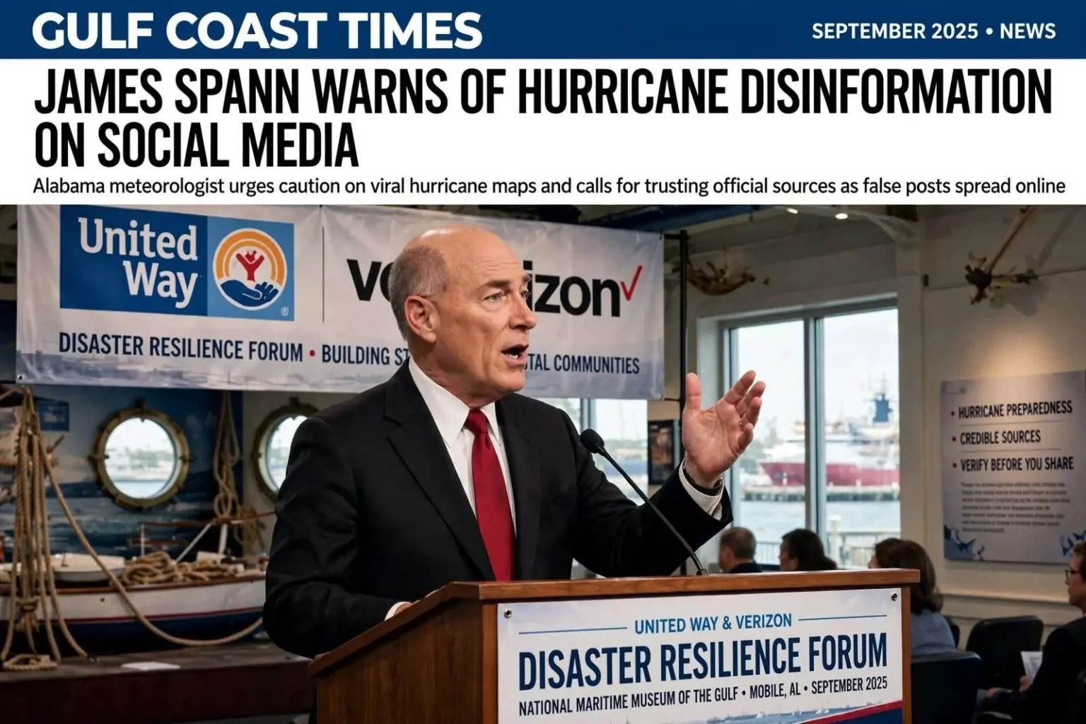
A frightening hurricane map can travel around social media in minutes. Alabama meteorologist James Spann says knowing who is behind such posts — and when to ignore them — matters.
Speaking Saturday at the United Way & Verizon Disaster Resilience Forum at the National Maritime Museum of the Gulf in Mobile, Spann warned Alabamians about sensational weather posts that can spread rapidly online, sometimes with real-world consequences.
He pointed to a social media post in May warning of a “killer hurricane” headed toward Florida. The post was false but was shared millions of times.
“We had people that cancelled beach vacations. We had people that cancelled elective surgery because some nitwit put this on Facebook and there is absolutely no truth to this, none whatsoever,” Spann said.
He told the audience there can also be a financial incentive behind some attention-grabbing posts. “They put this stuff out there to gain money from the creator content fund and we now live in a cesspool of disinformation,” Spann said.
The warning signs to watch for
For Spann, one warning sign of disinformation is a post claiming to know where a hurricane will be well into the future. He said there is “no skill” in making hurricane forecasts 10 days in advance and cautioned that while weather models can provide useful guidance, they are not crystal balls.
The distinction matters because the most viral fake maps tend to draw confident-looking tracks stretched far beyond the window where any meteorologist — armed with the same models — would commit to a landfall point. Forecast cones issued by federal forecasters carry a known and shrinking margin of error, and they exist precisely because the atmosphere cannot be pinned down a week or more ahead. A graphic that purports to show a specific city being struck ten days out is, in Spann’s framing, telling the audience something no legitimate forecaster would claim to know.
Instead, Spann urged people to turn first to credible sources, including the National Hurricane Center, the Mobile County Emergency Management Agency and his own statewide weather network. He also recommended listening to certified meteorologists, acknowledging they will not always get every forecast right but saying they are more trustworthy than many weather accounts on TikTok, Instagram, X and Facebook.
The local angle deserves emphasis for Gulf Coast residents. Mobile County’s emergency management agency is the office that activates evacuation guidance, coordinates shelters and pushes county-specific warnings when a storm threatens — the source whose guidance actually governs what happens in a neighborhood, not a reposted map. Pairing federal forecast products with local emergency management and established broadcast meteorologists gives residents a chain of accountability that anonymous accounts cannot offer.
The economics of fake storm maps
The “creator content fund” problem Spann described is a structural feature of modern platforms. Viral posts can be monetized, which means a dramatic hurricane graphic — accurate or not — can be worth real money to whoever produces it. The incentive runs entirely in the wrong direction: fear travels faster than accuracy, and platforms have historically been slow to punish fabricated weather content. Audiences who understand that the scariest map in their feed may literally be someone’s income stream are better equipped to pause before sharing.
The May post Spann cited showed the downstream costs clearly. Canceled beach vacations ripple through coastal economies that depend on late-spring and summer bookings, and a canceled elective surgery represents a real medical decision made on false information — the kind of consequence that never shows up in a view count but lands in clinics and hotels all the same.
A career that began with Frederic
The message aligns with a project Spann launched just last year. Spann, who has worked as a professional meteorologist since 1978, announced his own statewide weather network in July 2025, fulfilling what he called a longtime dream of providing weather coverage for the entire state. The 24/7 digital network was created to serve all 67 Alabama counties.
His experience with Alabama weather stretches back decades, including one storm etched into Gulf Coast history. Spann told the Mobile audience that Hurricane Frederic, which struck the Alabama coast in September 1979, was the first hurricane he covered in his career. He recalled reporting on the storm from Azalea Middle School — now Denton Magnet School of Technology — where he had access to a working telephone.
The detail says something about how completely the information environment has changed. In 1979, a working telephone line was the critical piece of storm-reporting technology available; today, the same storm would be tracked by satellite, radar and shared in real time across millions of devices. Nearly five decades later, the technology used to track and communicate hurricane threats has changed dramatically. So has the speed at which bad information can spread — from a single newsroom feeding a region to an unaccountable account reaching the whole country in an afternoon.
Spann has built much of his professional standing on that trust. Over a career that has made him one of the most recognized figures in Alabama broadcasting, his credibility has rested on getting the forecast right, explaining the uncertainty honestly and correcting course in public when the atmosphere does something unexpected. It is against that backdrop that he treats anonymous weather pages as a professional threat — not because they compete for ratings, but because they compete for trust without carrying any of the responsibility.
The season so far, and the hype around it
Spann also addressed the current hurricane season, telling the audience the Gulf had been fortunate so far and expressing confidence that what remains of the season could be “relatively quiet.” He pushed back on sensational predictions surrounding El Niño, saying the online “hype is off the charts.”
Climate signals like El Niño do shape seasonal outlooks, which is why agencies issue them — but a seasonal outlook is a statement about probabilities across an entire basin and a six-month window, not a promise about any single storm or any single coastline. The online conversation tends to flatten that nuance into confident claims about what the season “will” bring, which is precisely the overreach Spann has spent his career pushing back against.
But a quieter season is no reason to stop paying attention, he said. His advice was to identify a credible source before a storm threatens and to resist relying on questionable hurricane pages that appear on social media.
That preparation-first advice is the practical core of his message. The moment to choose a trusted forecast source is not when a system is in the Gulf and the feeds are flooded with competing maps; it is now, in calm weather, when a resident can verify who they are relying on. Gulf Coast households that have already decided where their information comes from — the hurricane center, the county emergency agency, a meteorologist with a name and a record — are far harder to mislead when a fake map starts to circulate.
Even in a year that may ultimately prove relatively quiet, Spann offered a reminder familiar to anyone who has lived through hurricane season on the Gulf Coast: “All it takes is one.”
Why the Gulf Coast takes the warning seriously
The phrase carries particular weight along the northern Gulf. Hurricane history for the Alabama coast includes storms that arrived in otherwise forgettable seasons — a single landfall can define a year that a seasonal outlook had rated calm. Mobile and Baldwin County residents who lived through Ivan in 2004 and other Gulf storms understand that the difference between a quiet season and a catastrophic one can be a single system that spins up, strengthens and arrives inside the forecast window when preparation still matters.
That is the gap the disinformation problem exploits. When a real storm threatens, residents urgently need clean information: what the track is, how confident forecasters are, when the wind arrives, which zones are told to leave. A feed crowded with exaggerated or fabricated content slows down exactly the decisions that protect lives. Emergency managers across the Gulf Coast have grown vocal about the same phenomenon — false rumor and doctored graphics consuming the attention that official instructions need.
The forum where Spann delivered the message was itself part of the response. Disaster resilience events bring together weather communicators, emergency agencies and community organizations to talk about preparation before the season’s peak, and the National Maritime Museum of the Gulf on Mobile’s waterfront has become a regular venue for programming about the region’s relationship with its weather and water. United Way’s role connects the warning to the recovery network that mobilizes after storms, while Verizon’s participation reflects the telecommunications industry’s stake in keeping residents connected when systems fail.
The takeaway for Alabama households
For the audience in Mobile, Spann’s checklist distilled into a handful of habits. Trust the National Hurricane Center’s official products over any shared graphic. Follow the Mobile County Emergency Management Agency for local decisions that affect evacuation and shelter. Rely on named, credentialed meteorologists — including those on his statewide network — rather than anonymous pages chasing engagement. Be skeptical of any map that claims certainty more than a few days out, and remember that someone may be monetizing the fear.
The deeper point Spann returned to is that credibility is a two-way street: meteorologists earn trust by being right and honest about being wrong, and audiences keep themselves safe by deciding in advance who has earned theirs. In a state where severe weather is a certainty even in quiet years, that decision may be the most valuable piece of hurricane preparation a household can make — it costs nothing, it can be done today, and it holds up when the next frightening map starts to spread.