How a 1994 Law Still Decides Who Owns the Sand on Orange Beach and Gulf Shores
Behind every beach renourishment project along Orange Beach and Gulf Shores lies a legal boundary fixed after Hurricane Isidore, decades of easements from waterfront owners, and a state law written to keep the Gulf's sand from washing homes away.
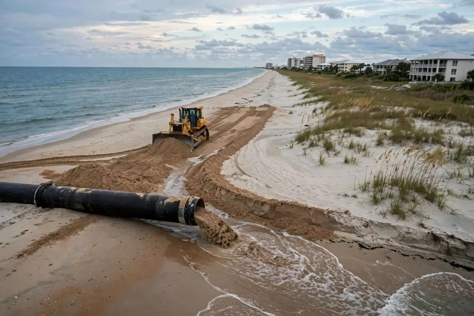
Every few years, dredges and bulldozers reshape the coastline in Orange Beach and Gulf Shores, pumping and pushing sand back onto beaches that the Gulf of Mexico is constantly trying to take away. The work looks simple from the road: trucks, pipes, piles of sand. But behind every renourishment project lies a surprisingly intricate web of state law, decades-old surveys and property rights that most beachgoers never think about.
The starting point for understanding it all is a basic fact about how the Gulf of Mexico moves. Sand does not sit still. It drifts steadily from east to west along Alabama’s coast, driven by currents that never stop working.
“The Gulf of Mexico is kind of like a big drain that swirls,” said Jim Griggs, a former director of the Alabama State Lands Division. “It’s the natural dynamics of the Gulf of Mexico that sand moves from the east to the west.”
That constant westward drift created a serious problem decades ago at Perdido Pass, the inlet separating Orange Beach from the Florida state line. Sand flowing west from Florida would reach the pass and drop into it rather than continuing its natural journey, starving the beaches immediately to the west.
“We were losing sand on the beaches particularly in Orange Beach and in Gulf Shores,” Griggs said. “The sand as it moves from Florida would hit Perdido Pass and drop in the pass and could not get out. On the west side of the pass, beaches were being eroded away.”
For years, Griggs and state officials tried to persuade the U.S. Army Corps of Engineers, which regularly dredges Perdido Pass to keep it navigable, to simply redirect the sand it removed back onto the eroding beaches to the west. The idea made sense conceptually, but it ran into a cost problem.
“That was cost prohibitive for the Corps because the Corps could pick up the sand when they would dredge the pass and discharge it further out, and so that sand never got back into the littoral system to renourish the beaches,” Griggs said. Eventually the Corps agreed to redeposit dredged sand west of the pass, but that still left the larger question of how to renourish the rest of the coastline and who had the legal authority to do it.
How the Pass Problem Led to a Legal Fix
That is where property law entered the picture. Alabama, like most coastal states, owns its submerged tidal lands down to what is known as the mean high tide line, a legal boundary calculated from tidal data rather than drawn on a map by eye.
“The mean high tide line is the average 19.6 years average of tidal fluctuation, discounting any sudden or unnatural changes such as hurricanes, tropical storms or dredging or flooding,” Griggs said. “Anything that’s unnatural does not change that ownership line.”
Establishing that line with any precision required real surveying work. Orange Beach engineer Vince Lucido, working alongside fellow engineer Tommy Oliver, helped lead the effort to fix the boundary using aerial photography of the beaches taken before Hurricane Isidore struck the Gulf Coast in 2002. The result, still referenced today, is informally known as the Lucido-Oliver line.
“That mean high tide line is then fixed legally by this act,” Griggs said, referring to the Beach Nourishment Act of 1994, legislation he helped write while serving as State Lands director. “That way if there is erosion the landowner never loses anything, but at the same time he doesn’t gain anything.”
Securing Easements From Waterfront Owners
Lucido, who now runs his own engineering firm in Orange Beach, said conditions on parts of the coastline before the line was fixed would be almost unrecognizable to visitors today.
“Especially down there at the pavilion at Gulf Shores at the park,” Lucido said. “Where the bulkhead, where the sidewalk is, it was gone. There was no sand. Sea ‘n’ Suds was sitting out over the water.” He described similarly rough conditions near the Gulf Place complex by The Hangout, where the annual Shrimp Fest is now held. “Down there where we have the Shrimp Fest, that was just water up to the sidewalk,” he said.
Fixing the erosion required more than engineering. Before any sand could be placed, cities and the state needed permanent easements from waterfront property owners, since the beach nourishment permits available to municipalities under Alabama law require proof of legal access to the land where the work will happen.
“Only municipalities in Alabama are eligible to obtain a beach nourishment permit,” said Phillip West, Orange Beach’s Director of Coastal Resources. “The state is going to require the city, before we place the material or before they even give us a permit, we have to show that we have permanent easement on that private property north of mean high tide line all the way to the coastal construction line for the maintenance and regulation of that beach.”
Securing those easements from every waterfront owner between Gulf Shores and the Florida state line was not a quick process. Griggs held a series of public meetings, required by law, to walk residents through what the state was asking for and why.
“There was a lot of hell raised about it because a lot of those landowners along the front back then, they were afraid the state was trying to take their land,” Griggs said. “I tried to explain that if you don’t renourish the beach you may not have a house. It could erode away until your house falls in.”
When Erosion Nearly Took Homes at Little Lagoon
The stakes were not hypothetical. Homes just west of the Little Lagoon pass came dangerously close to being lost to encroaching water after the pass was cut by the state highway department, according to Griggs, a situation that ultimately obligated the state to maintain that stretch of beach permanently.
“It eroded so badly that when Little Lagoon was cut, those houses on the west were about to tumble into the Gulf,” Griggs said. “Because of that cut by the state highway department, the state is under a perpetual agreement to maintain that beach just west of the pass for those landowners.”
Lucido said gathering the paperwork needed to formalize access rights across so many individual parcels was its own undertaking. “There are so many owners it took a while for the cities to get all the owners to sign off on them,” he said. “They needed an easement to be able to get the equipment on the beach to place the sand. We had to write easements for every property owner on the beach from Gulf Shores to the state line. There were quite a few physical documents that we had to write up. It’s a big file, that’s for sure.”
Once secured, those easements gave Orange Beach and Gulf Shores the legal footing to manage their beaches on the state’s behalf, since Alabama delegates day-to-day oversight, and the cost, of renourishment to the municipalities themselves.
What ‘Public Beach’ Actually Means in Alabama
“We consider ourselves stewards of the state’s beach, and I don’t mean by ownership, but as a resource,” West said. “We are taking care of these beaches to the level that we are for the benefit of the entire state, and for the citizens of the state.”
Ownership of the sand, however, is only part of the equation. Alabama is what is known as a mean high tide line state, meaning waterfront property owners hold title only down to that boundary. Everything south of it belongs to the state, but that does not automatically translate into unrestricted public access.
“Alabama is a mean high tide line state, meaning a riparian owner only owns down to the mean high tide line,” West said. “I can go walk the beach, traverse the beach, fish and do all that. The public has the right to traverse that public beach, but they don’t have the right to squat on it. That’s why we call it nuances.”
West said the distinction matters in practical terms. A vendor cannot simply set up beach chair rentals on state-owned sand without the adjacent property owner’s permission, even though the land technically belongs to the state and the state itself does not typically get involved in enforcing that particular rule.
Both cities lean on the fixed mean high tide line to enforce beach ordinances, including rules that keep pop-up canopies positioned north of the line so they do not block other beachgoers’ views, and regulations tied to the Leave Only Footprints campaign launched in 2015, which bans glass on the beach and requires personal items to be removed each evening at dusk.
A Shoreline That Keeps Moving
While the legal boundary is fixed, the physical shoreline is anything but static. Lucido said the actual edge of the water can shift dramatically depending on weather and season.
“From the mean high tide line it belongs to the state, it’s public,” Lucido said. “It varies from day to day because of the erosion that can occur, especially during a storm. It may erode way up close to the dunes, then a couple of weeks later nature kind of heals itself. Things move back to where they were. That’s one reason we had to establish the line, to have some permanent reference point to establish an easement.”
Griggs said that fluctuation is exactly why the legal boundary needed to be separated from the ever-changing waterline. “Ostensibly it was all private land down to the water,” he said. “But there are two different things. There’s ownership of the land, which is what we were dealing with. And there’s the public right to cross the land. That’s sort of like an easement. People have been walking the beachfront for millions of years, and it’s more like the right to cross along the water’s edge.”
Waterfront owners do benefit directly when renourishment projects move forward, West said, since contractors typically place far more sand than the minimum needed to satisfy the fixed boundary, accounting for the fact that freshly placed sand has not yet settled the way naturally deposited sand has.
“When we fill the beach, we fill up to and well beyond that line,” West said. “We’re going to fill 200 or 300 feet past that line in some cases, which we do. We do that because the beach has to go through a process, it has to equilibrate. When you place it out there with equipment, it’s not like Mother Nature shaped it, so she’s going to shape it and you’ll lose some of that depth.”
Ultimately, officials say, all of it circles back to the same relentless movement of sand through the Gulf’s littoral system, a process that has reshaped the Alabama coast for centuries and will keep doing so regardless of how carefully cities try to manage it.
“You cannot interrupt that system of sand moving from east to west in the Gulf of Mexico,” Griggs said. “If you do interrupt it, you’re going to starve whatever is on the west side. You can see so much evidence to the interruption of that system even back to the Civil War era. There was so much erosion back then. Pelican Island just south of Dauphin Island once extended all the way out to the lighthouse, and the lighthouse was 45 acres at one time. And now it’s nothing but the light now.”